


What's Happening?
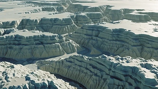
Scientists have created the most detailed map yet of the terrain beneath Antarctica's ice sheet, revealing a diverse landscape of mountains, canyons, valleys, and plains. Using high-resolution satellite observations and ice-flow perturbation analysis,
researchers have mapped the entire continent, including previously uncharted areas. This new map identifies over 30,000 previously unknown hills and other features. The improved understanding of the subglacial landscape is crucial for predicting the climate-related retreat of Antarctica's ice sheet, as rough terrain can slow this process. The study, led by glaciologist Robert Bingham from the University of Edinburgh, was published in the journal Science.
Why It's Important?
The Antarctic Ice Sheet holds about 70% of the world's freshwater, and its retreat due to climate change could significantly contribute to global sea-level rise. Understanding the subglacial topography is essential for accurate climate models and forecasts, which inform international climate policy and adaptation strategies. The new map provides a more complete picture of Antarctica's landscape, aiding in the identification of areas that require further study and helping to refine predictions of future sea-level changes.
What's Next?
The map will be used to enhance models that project future sea-level rise, informing reports by the Intergovernmental Panel on Climate Change (IPCC). Researchers will likely focus on areas identified by the map for more detailed field surveys. The findings may also prompt further studies into the historical geology of Antarctica and its role in past climate events. As the map fills gaps in previous surveys, it will guide future research priorities and resource allocation for Antarctic exploration.