
What's Happening?
Families in Reading, Pennsylvania, are enjoying the final days of summer activities, including the city's 'Wacky Water Wednesday' events, before the school year commences. Concurrently, a Flood Watch has
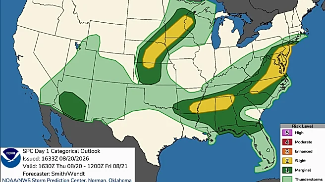
been issued for portions of Pennsylvania, including Lower Bucks County and Upper Bucks County, and northern Delaware and New Jersey. The watch is in effect from Thursday afternoon until Friday morning. This weather alert indicates the possibility of flash flooding due to excessive rainfall, with showers and thunderstorms expected through Thursday evening. Rainfall rates could reach 1 to 3 inches per hour in stronger storms, with total accumulations of 1 to 2 inches, and some areas potentially receiving 3 to 5 inches, which could lead to flash flooding. The affected areas include urban centers and poor drainage locations, where creeks and streams may overflow their banks. Residents are advised to monitor forecasts and be prepared for potential Flash Flood Warnings.
Why It's Important?
The convergence of end-of-summer activities and a significant weather alert highlights immediate public safety concerns for residents in the affected regions of Pennsylvania, Delaware, and New Jersey. The Flood Watch underscores the potential for widespread disruption, including property damage, transportation delays, and risks to personal safety. For local communities, this means a heightened need for preparedness and vigilance, potentially impacting daily routines and the start of the school year. Economically, flash flooding can lead to substantial costs for emergency services, infrastructure repairs, and business interruptions. The repeated nature of such weather events also points to broader challenges in urban planning and climate resilience, as communities grapple with increasingly intense rainfall patterns. The situation emphasizes the critical role of local weather advisories in safeguarding public welfare and infrastructure.
What's Next?
Residents in the areas under the Flood Watch are advised to continue monitoring local weather forecasts and be prepared to take action if Flash Flood Warnings are issued. Emergency services will likely remain on high alert to respond to any incidents of flooding or related emergencies. Local authorities may issue further guidance regarding school openings, road closures, or evacuation procedures depending on the severity of the rainfall and subsequent flooding. Businesses in affected areas may need to implement contingency plans to protect assets and ensure employee safety. Post-event, assessments will be conducted to determine the extent of any damage and the resources required for recovery efforts. The ongoing threat of heavy rainfall also prompts a review of existing flood mitigation strategies and infrastructure in these vulnerable regions.
Beyond the Headlines
This event subtly underscores the growing challenges faced by urban and suburban communities in managing extreme weather phenomena, which are becoming more frequent and intense. Beyond the immediate concerns of safety and property, there are deeper implications for urban infrastructure planning, particularly regarding drainage systems and flood defenses. The need for continuous public education on flood preparedness and the importance of heeding weather advisories becomes paramount. Furthermore, the disruption to the end-of-summer period, a time typically associated with leisure and preparation for the academic year, highlights the psychological and social impacts of such events on community well-being. It also brings into focus the broader conversation around climate resilience and how local governments and communities adapt to changing environmental conditions to protect their citizens and economies.