




What's Happening?
A recent study utilizing the Standardized Precipitation Index (SPI) has confirmed substantial meteorological drought variability in Sangli district, Maharashtra, India, over a 39-year period from 1985 to 2023. The analysis, which used daily rainfall data
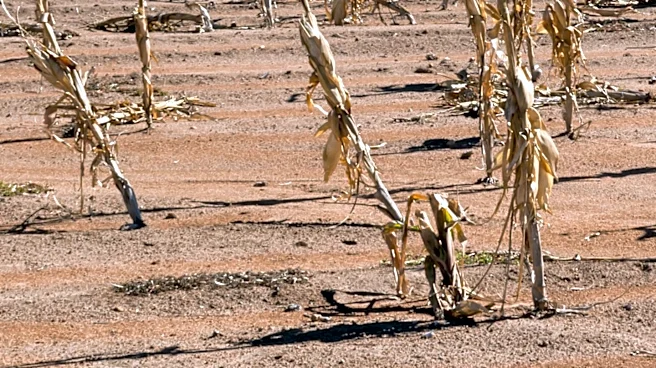
from the NASA POWER Project, identified 2002, 2015, and 2018 as major drought years, with SPI values of -2.31, -2.05, and -1.87, respectively. Extreme long-term drought conditions, indicated by an SPI-12 value of -2.80, were particularly noted during 2002 and 2015. The study also conducted a spatial analysis, revealing that the southern, central, and eastern parts of Sangli district exhibited higher drought vulnerability. In contrast, the northern and western areas of the district experienced relatively more stable rainfall conditions. This multi-timescale SPI approach provides critical information for understanding drought patterns and their geographical distribution within the region.
Why It's Important?
The findings from this drought assessment are crucial for agricultural planning and water resource management in Sangli district, an agriculturally significant area known for sugarcane and fruit cultivation. Identifying specific drought-prone areas and understanding the intensity and frequency of dry periods allows for more targeted interventions. Farmers in the southern, central, and eastern parts of Sangli, which are more vulnerable, can anticipate greater risks to crop yields and water availability, potentially leading to economic losses. Conversely, areas with more stable rainfall might be better positioned for certain agricultural activities. This detailed drought mapping can inform policy decisions regarding irrigation projects, crop selection, and drought relief efforts, ultimately aiming to enhance resilience against climatic hazards and support the socio-economic stability of the region.
What's Next?
The insights gained from this study are expected to inform future agricultural planning and water resource management strategies in Sangli district. Local authorities and agricultural departments can utilize the spatial analysis to prioritize drought mitigation measures in the most vulnerable southern, central, and eastern regions. This could include implementing water conservation techniques, developing drought-resistant crop varieties, and improving irrigation infrastructure in these specific areas. Furthermore, the identification of major drought years provides a historical context that can aid in forecasting and preparing for similar events in the future. Continuous rainfall monitoring and the application of multi-timescale SPI approaches will be essential for ongoing drought assessment and adaptive management in the face of changing climatic conditions.
Beyond the Headlines
The study's detailed analysis of drought vulnerability in Sangli district underscores broader challenges faced by agricultural regions susceptible to climate variability. Beyond immediate agricultural impacts, prolonged drought conditions can lead to significant socio-economic consequences, including food insecurity, rural migration, and increased pressure on public services. The reliance on indices like SPI highlights the importance of scientific tools in understanding complex environmental phenomena and informing policy. This research also implicitly calls for integrated approaches that combine meteorological data with socio-economic factors to develop comprehensive vulnerability assessments. Such holistic understanding is vital for building long-term resilience in communities that are heavily dependent on rain-fed agriculture and are increasingly exposed to the impacts of climate change.