


What's Happening?
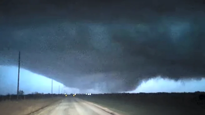
A significant weather event is expected to unfold across the central United States, with meteorologists predicting severe storms and a potential tornado outbreak. The system, moving from Texas to the Ohio Valley, is anticipated to bring damaging winds,
large hail, and flash flooding. AccuWeather forecasters have indicated that the combination of warm, moisture-rich Gulf air and cooler air masses will create conditions conducive to tornado formation. The National Weather Service has already issued severe thunderstorm warnings in regions like southeastern Oklahoma. The threat is expected to escalate, with live tracker maps and real-time alerts being crucial for residents in the affected areas.
Why It's Important?
The potential tornado outbreak poses a significant risk to life and property across multiple states. Such severe weather events can lead to widespread damage, disrupt daily life, and strain emergency services. The economic impact could be substantial, affecting businesses, infrastructure, and agriculture. Residents in the affected areas may face power outages, property damage, and potential displacement. The situation underscores the importance of preparedness and timely communication from meteorological services to mitigate risks.
What's Next?
As the storm system progresses, residents in the central U.S. are advised to stay informed through weather updates and heed warnings from local authorities. Emergency services and local governments are likely to be on high alert, ready to respond to any incidents. The situation may prompt discussions on improving infrastructure resilience and emergency response strategies in tornado-prone regions.