


What's Happening?
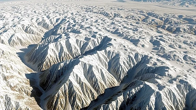
NASA's Terra satellite, equipped with the Moderate Resolution Imaging Spectroradiometer (MODIS), captured images of snow covering large areas of southern Argentina's high plains on April 3, 2026. The snow resulted from a storm in early April, which brought
above-average precipitation to the region. The snow was particularly notable on the eastern, arid side of the Andes, where strong winds carried snow eastward. The imagery also highlighted the stark snow lines and the milky blue or turquoise appearance of glacier-fed lakes due to suspended sediment.
Why It's Important?
The satellite imagery of snow in southern Argentina provides valuable data for understanding weather patterns and climate conditions in the region. The ability to monitor such events from space is crucial for meteorologists and climate scientists, as it helps in predicting weather patterns and assessing the impact of climate change. The data can also aid in managing water resources and planning for agricultural activities in the region. The imagery from NASA's Terra satellite underscores the importance of satellite technology in environmental monitoring and research.
What's Next?
The snow in southern Argentina is expected to melt quickly, as observed in subsequent satellite images. However, the data collected will continue to be analyzed to improve understanding of the region's climate dynamics. Future satellite missions will build on this data, enhancing the ability to monitor and predict environmental changes. The ongoing research will contribute to global efforts to understand and mitigate the impacts of climate change.