
What's Happening?
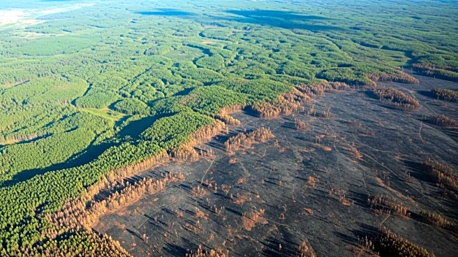
NASA's Landsat satellites play a crucial role in managing wildfires by providing data that helps assess the severity and extent of fires. This information is vital for land managers and scientists to plan
recovery efforts, improve safety, and prevent further damage to life, property, and natural resources. Landsat data has been instrumental since the 1970s in documenting the location and extent of burned areas, the severity of fires, and the regrowth of land post-fire. The data allows for estimating pollution levels released into the air and monitoring post-fire recovery. Landsat's imaging capabilities enable land managers to prioritize recovery efforts and guide decisions on replanting and erosion control.
Why It's Important?
The use of Landsat data is significant for both local and global decision-making regarding wildfire management. It provides an inexpensive method to gauge the extent of large fires, which is crucial for prioritizing recovery efforts and guiding replanting and erosion control. The data also helps assess potential hazards such as flooding and erosion, which can occur when fires remove plant material from the forest floor. Additionally, Landsat data aids in estimating air quality and carbon emissions, improving models that forecast air quality and monitor carbon storage. This comprehensive approach to wildfire management helps protect ecosystems and human communities from the adverse effects of fires.
What's Next?
Continued use of Landsat data will enhance the ability of land managers to respond effectively to wildfires. The US Forest Service's Burned Area Emergency Response (BAER) will continue to use this data to assess potential hazards and determine response plans. As climate change increases the frequency and intensity of wildfires, the role of Landsat in monitoring and managing these events will become even more critical. Future advancements in satellite technology may further improve the accuracy and timeliness of data, aiding in more effective wildfire management strategies.
Beyond the Headlines
The integration of Landsat data into wildfire management highlights the importance of technological advancements in environmental conservation. It underscores the need for continued investment in satellite technology to address ecological challenges. The historical data provided by Landsat also offers insights into forest succession and ecological recovery, contributing to a deeper understanding of natural processes. This knowledge can inform broader conservation efforts and policy decisions aimed at preserving forest ecosystems.