


What's Happening?
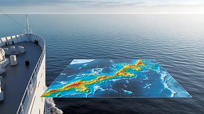
The NOAA Ship Rainier is set to begin mapping over 8,000 square nautical miles of federal waters near Kingman Reef and Palmyra Atoll in the Pacific Ocean. This initiative is part of the U.S. Offshore Critical Minerals Mapping Plan, following President
Trump's Executive Order 14285. The project aims to map and characterize the seabed using advanced technology, including multibeam echo sounders and autonomous underwater vehicles. The data collected will be used to create publicly accessible maps and images, aiding in the identification of potential critical mineral deposits. These minerals are essential for various industries, including defense and technology.
Why It's Important?
This mapping project is significant for the U.S. as it seeks to secure critical mineral resources necessary for manufacturing and technology sectors. The availability of these minerals is crucial for maintaining the resilience of U.S. supply chains, especially in defense and electronics. By enhancing the understanding of seabed composition, the project could lead to increased exploration and sustainable management of these resources. This initiative also aligns with broader efforts to reduce dependency on foreign mineral imports, thereby strengthening national security and economic stability.