



What's Happening?
The Philippine government has allocated P1 billion to expand Project Nationwide Operational Assessment of Hazards (NOAH), a program focused on strengthening flood management, hazard monitoring, and disaster risk reduction systems. This initiative comes
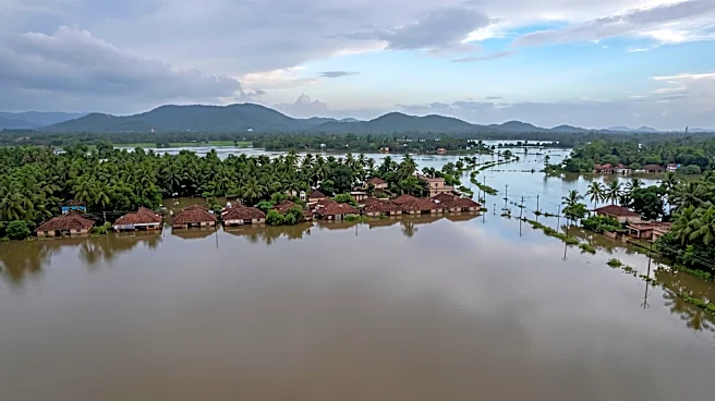
as the country faces increasing impacts of climate change, including widespread flooding from heavy monsoon rains in regions like Central Luzon and Metro Manila. President Marcos directed this funding, emphasizing a data-driven approach to governance and infrastructure spending. The University of the Philippines Resilience Institute (UPRI), which manages Project NOAH, will utilize the funds to transform scientific knowledge into practical actions aimed at protecting lives and building more resilient communities. The allocation includes P935 million for research services and P65 million for general management and supervision of NOAH's implementation, as part of the UP System's appropriation under the 2026 General Appropriations Act.
Why It's Important?
This significant investment in Project NOAH underscores the Philippine government's commitment to addressing the escalating challenges posed by climate change and natural disasters. By enhancing flood management and hazard monitoring, the country aims to mitigate the severe economic and social disruptions caused by extreme weather events. Improved forecasting capabilities, such as NOAH's impact-based system, which can predict flooding and its effects on infrastructure a day in advance, are crucial for timely evacuations and resource deployment. This proactive approach can save lives, reduce property damage, and safeguard livelihoods, particularly in vulnerable communities. The collaboration between government agencies, academic institutions like UPRI, and local government units signifies a comprehensive strategy to integrate scientific data into national planning and infrastructure development, fostering long-term resilience against climate-related hazards.
What's Next?
With the P1 billion funding, Project NOAH is set to expand its operations, focusing on high-resolution mapping of major river basins, hazard assessments, and land-use planning. The program will also support Light Detection and Ranging (LiDAR) drone topographic surveys, capacity-building initiatives with state universities and colleges, native tree mapping, and sediment erosion assessments. Furthermore, the project will explore mapping hidden waterways, implementing nature-based solutions, and utilizing artificial intelligence and analytics for disaster risk management. These efforts are expected to lead to more accurate and faster impact-based forecasting, providing better information for decision-making and effective flood management. The Department of Public Works and Highways (DPWH) will continue updating flood management master plans, guided by scientific data from UPRI's NOAH, to ensure they reflect current climate realities and protect Filipinos from annual flooding.
Beyond the Headlines
The expansion of Project NOAH highlights a broader shift towards evidence-based governance in the Philippines, where scientific data and research are increasingly integrated into national policy and infrastructure development. This initiative not only addresses immediate disaster risks but also fosters a culture of scientific literacy and innovation within government and academic sectors. The emphasis on long-term flood control measures, including de-clogging waterways, improving drainage systems, and proper land-use planning, reflects a recognition of the systemic nature of climate change impacts. By investing in advanced technologies like LiDAR and AI, the Philippines is positioning itself as a leader in climate adaptation strategies, potentially offering valuable lessons for other nations grappling with similar environmental challenges. This commitment to science-backed solutions can enhance public trust and encourage greater community participation in disaster preparedness and climate resilience efforts.