


What's Happening?
Central Ohio is bracing for a shift in weather patterns as a storm system moves into the region, bringing increased chances of showers and thunderstorms starting Saturday. According to forecasts, the weather will transition from the recent streak of pleasant
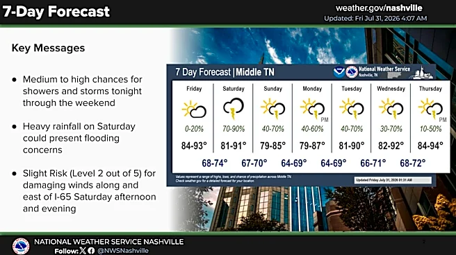
conditions to more humid and wet weather as a surface low pressure system tracks northeast toward Lake Erie. This change is expected to bring periods of heavy rainfall, particularly on Saturday afternoon and evening, with the potential for isolated flooding due to slow-moving storms. The unsettled weather is anticipated to continue into Sunday, with scattered storms persisting into early next week as an upper-level low stalls near West Virginia. This system will keep the chance for showers in the forecast, especially in Central Ohio and areas east of the Scioto River Valley. Temperatures are expected to cool over the weekend, with highs around 80 degrees, before gradually warming up mid-next week.
Why It's Important?
The incoming storm system poses a risk of localized flooding in Central Ohio, which could impact communities, infrastructure, and daily activities. The potential for heavy rainfall and gusty winds may lead to disruptions, particularly in areas prone to flooding. Residents and local authorities need to prepare for possible weather-related challenges, including power outages and transportation delays. The weather shift also highlights the importance of monitoring weather forecasts and staying informed about potential severe weather alerts. As the region experiences a transition from dry to wet conditions, the impact on agriculture, outdoor events, and local businesses could be significant, necessitating contingency plans to mitigate adverse effects.
What's Next?
As the storm system progresses, residents in Central Ohio should remain vigilant and prepared for changing weather conditions. Local authorities may issue weather advisories or warnings if the situation escalates, and community members are encouraged to stay updated through reliable weather channels. The gradual warming trend expected mid-next week suggests a return to more stable weather, but the possibility of isolated showers will persist. Monitoring the movement of the upper-level low and its impact on the region will be crucial for planning and response efforts. Additionally, assessing the aftermath of the storm, including any damage or flooding, will be necessary to ensure community safety and recovery.