


What's Happening?
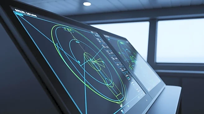
Researchers at Texas A&M University have developed a smart navigation system called SMART-SEA, designed to prevent collisions between ships and stationary structures like offshore platforms. The system uses raw radar imaging data combined with advanced
machine learning to provide real-time guidance to seafarers. SMART-SEA can detect stationary objects in all weather conditions and offers data delivery in visual, audible, or combined formats. The system was developed with input from Texas A&M Galveston faculty, industry experts, the U.S. Navy, and the U.S. Coast Guard. It aims to provide seafarers with optimal maneuvers to ensure vessel safety without autonomously controlling the vessel.
Why It's Important?
The development of SMART-SEA addresses a significant safety concern in the maritime industry by reducing the risk of collisions, which can lead to environmental disasters and loss of life. By providing real-time guidance, the system enhances decision-making for seafarers, potentially preventing accidents and improving overall maritime safety. The collaboration with industry experts and government agencies ensures that the system is practical and effective in real-world scenarios. The project's initial funding from the U.S. Department of the Interior and the U.S. Department of Energy highlights the importance of advancing maritime safety technologies.
What's Next?
The researchers at Texas A&M plan to secure additional funding to continue testing SMART-SEA on various vessels and improve the system's capabilities. The goal is to make the system adaptable for recreational vessels, which could significantly reduce boating accidents. As the system proves its effectiveness, it may see wider adoption in the maritime industry, leading to enhanced safety standards. The ongoing development and testing will likely involve further collaboration with industry and government partners, ensuring that SMART-SEA remains at the forefront of maritime safety technology.