







What's Happening?
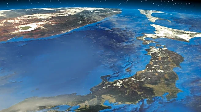
Japan has lodged a protest with the United Nations over the depiction of the disputed Kuril Islands on a newly adopted world map. The UN recently adopted the Equal Earth projection, which aims to provide a more accurate representation of continental sizes
compared to traditional Mercator maps. While Japan supported the resolution for the new projection, it objects to how the map portrays the Kuril Islands as Russian territory. Japanese government spokesperson Minoru Kihara stated that the depiction contradicts Japan's official position on the islands, which it refers to as the Northern Territories. These four southernmost islands have been under Russian control since the end of World War II, but Japan maintains its claim of sovereignty.
Why It's Important?
While this dispute directly involves Japan and Russia, it holds broader significance for international relations and the U.S. as a key ally of Japan. The U.S. generally supports its allies in territorial disputes and maintains an interest in the stability of the Indo-Pacific region. The UN map controversy underscores the persistent nature of territorial claims and their potential to fuel diplomatic tensions. For the U.S., maintaining strong alliances in the region is crucial for its strategic interests, including trade routes and regional security. Any escalation of such disputes, even symbolic ones like map depictions, can complicate diplomatic efforts and potentially impact regional stability, which in turn affects U.S. foreign policy and economic interests in Asia.
What's Next?
Japan has formally protested to the operator of the map site and demanded a correction, aiming to prevent the spread of what it considers misconceptions about its territories. The Japanese government will likely continue to assert its claim over the Kuril Islands through diplomatic channels and international forums. Russia, which has controlled the islands since WWII, is expected to maintain its stance, especially following recent actions like President Vladimir Putin's visit to the disputed territory. This ongoing disagreement suggests that the territorial dispute will remain a point of contention between the two nations, with potential for further diplomatic exchanges and statements from both sides regarding the sovereignty of the islands.
Beyond the Headlines
This seemingly minor cartographic dispute highlights the profound impact of maps on national identity, historical narratives, and international law. The way territories are depicted on maps can reinforce or challenge sovereignty claims, influencing public perception and diplomatic discourse. For Japan, the Kuril Islands are not just a geographical feature but a deeply ingrained part of its historical and national identity, making any perceived misrepresentation a significant issue. The incident also underscores the complexities of international organizations like the UN, which must navigate sensitive political issues while striving for accuracy and neutrality. It serves as a reminder that even in the digital age, the symbolic power of maps remains potent in shaping geopolitical realities and national aspirations.