
What's Happening?
Henderson County is currently under a Flash Flood Warning, issued by the National Weather Service, which is effective until 7 p.m. CDT. The warning comes after reports indicated that some areas within
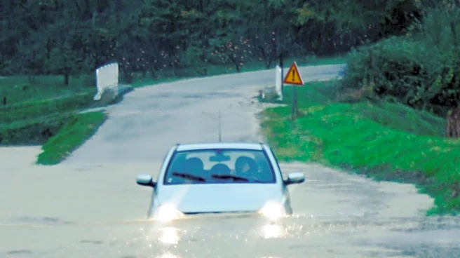
the county have received between 8 to 10 inches of rain. Flash flooding is already occurring in the region. Authorities are urging drivers to exercise extreme caution, remain aware of their surroundings, and be vigilant about road conditions. A critical advisory has been issued for drivers to turn around if they encounter flooded roads, emphasizing that the majority of flood-related fatalities happen inside vehicles. The significant rainfall has led to hazardous conditions, prompting concerns for public safety and infrastructure.
Why It's Important?
The flash flood warning in Henderson County highlights the immediate dangers posed by severe weather events, particularly the rapid accumulation of rainfall. Such events can lead to significant disruptions in daily life, including road closures, potential damage to property, and risks to human life. The emphasis on driver safety underscores a critical public health concern, as many individuals underestimate the power of floodwaters. Economically, flash floods can cause substantial damage to local infrastructure, agricultural lands, and businesses, leading to costly recovery efforts. For residents, the event can result in displacement, loss of essential services, and long-term financial burdens. The situation also stresses the importance of effective weather monitoring and timely public advisories to mitigate potential harm.
What's Next?
As the Flash Flood Warning remains in effect until 7 p.m. CDT, residents of Henderson County should continue to monitor local weather updates and adhere to safety guidelines issued by the National Weather Service and local authorities. Emergency services will likely remain on high alert to respond to any incidents of flooding or stranded individuals. Post-warning, assessments will be necessary to determine the full extent of any damage to roads, bridges, and private property. Local government and utility companies will likely initiate recovery and repair operations. Public awareness campaigns regarding flood safety may also be reinforced to prevent future incidents, especially concerning the dangers of driving through flooded areas.
Beyond the Headlines
Beyond the immediate threat, this flash flood event in Henderson County underscores broader issues related to climate patterns and urban planning. The occurrence of 8-10 inches of rain in a localized area points to the increasing intensity of weather phenomena, which can overwhelm existing drainage systems and infrastructure not designed for such volumes. This event could prompt discussions on improving flood resilience, including investments in better stormwater management, updated building codes, and enhanced early warning systems. It also highlights the psychological impact on communities frequently affected by severe weather, leading to increased stress and anxiety among residents. The incident serves as a reminder of the continuous need for communities to adapt to changing environmental conditions and strengthen their preparedness strategies.