


What's Happening?
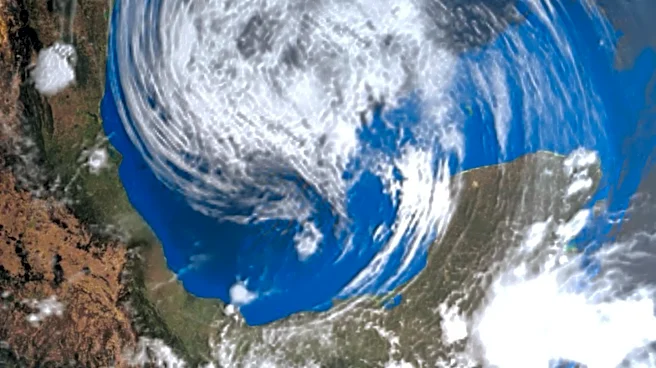
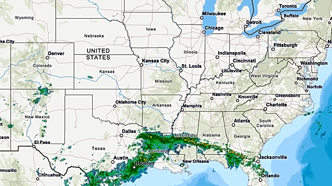
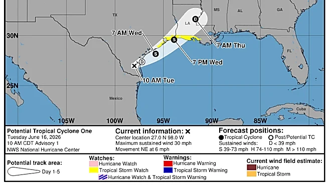
The National Hurricane Center (NHC) has raised the likelihood of a low-pressure system in the Gulf of Mexico developing into the first tropical depression or storm of the season. As of the latest update, the system, currently over northeastern Mexico,
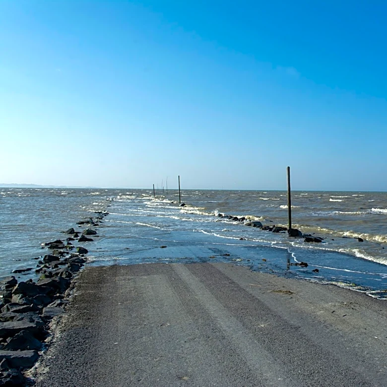
has a 50% chance of development in the next two days and a similar chance over the next week. The NHC warns that regardless of whether it becomes a named storm, significant rainfall is expected in southern and eastern Texas, as well as parts of Louisiana and Mississippi. This could lead to widespread, life-threatening flash, urban, and river flooding, along with gusty winds and coastal flooding along the northwestern Gulf Coast. The system may re-emerge over the Gulf by late Tuesday or Wednesday, with conditions potentially conducive for a short-lived tropical storm.
Why It's Important?
The potential development of this system into a tropical storm, possibly named Arthur, marks the first significant weather event of the 2026 Atlantic hurricane season. The NHC's warnings highlight the risk of severe flooding, which could impact infrastructure, disrupt daily life, and pose safety risks in affected areas. The Gulf Coast, particularly regions like New Orleans and Houston, may face challenges due to their drainage systems' capacity to handle intense rainfall. This situation underscores the importance of preparedness and timely response to mitigate the impact of such weather events on communities and local economies.
What's Next?
The NHC will continue to monitor the system closely, providing updates every six hours. Residents in the affected areas are advised to stay informed and prepare for potential tropical storm conditions. Local authorities may issue watches or warnings as the situation develops. The broader implications for the hurricane season remain uncertain, but this event serves as a reminder of the need for vigilance and readiness throughout the season, which runs until November 30.