







What's Happening?
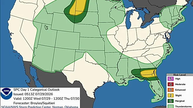
A cold front is moving across Middle Tennessee, bringing a marginal risk of severe storms, particularly east of I-65. The National Weather Service in Nashville has indicated a 2 out of 5 risk for damaging winds and a potential for flash flooding, with
a low risk of isolated weak tornadoes. The front is expected to bring showers and thunderstorms, with temperatures reaching highs near 89 degrees and heat index values up to 97. The weather is expected to cool down significantly after the front passes, with temperatures dropping to around 69 degrees at night. The weekend and early next week are forecasted to be cooler and wetter than usual for August.
Why It's Important?
The severe weather poses a risk to residents in Middle Tennessee, particularly those east of I-65, where the threat of strong storms is higher. The potential for damaging winds and flash flooding could impact infrastructure, disrupt travel, and pose safety risks to the public. The cooler temperatures following the front may provide some relief from the summer heat, but the persistent rain could lead to localized flooding, especially in areas prone to water accumulation. This weather pattern highlights the need for residents to stay informed and prepared for sudden changes in weather conditions.
What's Next?
Residents are advised to stay alert for weather warnings and to have a plan in place in case of severe weather. The National Weather Service recommends having a way to receive alerts, such as a phone with notifications or a NOAA radio. As the front moves through, the severe weather threat is expected to diminish, transitioning to a pattern of rain and cooler temperatures. The weather is expected to remain unsettled into next week, with continued chances of showers and thunderstorms.