




What's Happening?
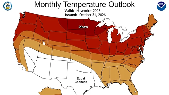
North Carolina is anticipating a winter characterized by milder-than-average temperatures and above-average precipitation, influenced by a 'super El Niño' event that has a 90% chance of continuing from fall into winter. According to the Climate Prediction
Center’s Seasonal Outlooks, North Carolina has a 30% chance of milder-than-average temperatures and the Piedmont Triad has a 40-50% chance of above-average precipitation during the 2026-2027 winter season. While increased precipitation could help alleviate drought conditions, it does not necessarily guarantee heavy snowfall, especially in areas like Winston-Salem and Greensboro. Strong El Niño events, such as those in 1997 and 2015, have historically brought significant precipitation events, but snowfall totals can vary widely. For instance, December 1997 saw over 5 inches of snow, while December 2015, despite being the fourth-wettest on record for Greensboro, reported no snowfall until January 2016. The interaction of the strong El Niño with other climate patterns like the Polar Vortex and North American Oscillation will be crucial in determining the winter's exact conditions.
Why It's Important?
The winter outlook for North Carolina, shaped by the super El Niño, carries significant implications for various sectors. The potential for increased precipitation is a positive development for drought-stricken areas, offering relief to agricultural communities and improving water resource levels. However, the forecast for milder temperatures and variable snowfall could impact winter tourism, particularly ski resorts in the mountains, which rely on consistent snow cover. For residents, the risk of flash flooding and severe thunderstorms, even in winter, necessitates heightened preparedness. The complexity of forecasting snowfall during strong El Niño years, where warmer temperatures can lead to rain instead of snow, highlights the challenges for local authorities and emergency services in planning for winter weather events. The economic impact could be mixed, with drought relief benefiting some sectors while reduced snowfall affects others.
What's Next?
As winter approaches, North Carolina residents should prepare for potential swings in weather, including increased chances of rain, flash flooding, and severe thunderstorms. While heavy snow events are possible, they are not guaranteed, and residents should not expect consistently high snowfall totals. The WXII 12 Weather team will continue to monitor models and provide short-term forecasts, emphasizing preparation over panic. This includes staying informed about weather alerts and having plans for various types of winter precipitation. The ongoing monitoring of the El Niño's interaction with the Polar Vortex and other pressure patterns will be key to refining winter forecasts. Communities and emergency services will need to remain adaptable, focusing on managing heavy rainfall and potential severe weather rather than solely on snow accumulation.
Beyond the Headlines
The nuanced impact of a 'super El Niño' on North Carolina's winter weather underscores the broader complexities of climate change and its regional manifestations. While El Niño is a natural phenomenon, its intensity and interaction with other climate systems can be influenced by global warming, leading to unpredictable and sometimes extreme weather patterns. This situation prompts a deeper examination of climate resilience strategies at the state and local levels, moving beyond traditional seasonal expectations. It also highlights the importance of public education on climate science, enabling communities to understand and adapt to evolving weather trends. The challenge lies in balancing the benefits of increased precipitation for drought relief with the risks of severe weather events, requiring comprehensive planning that considers a wider range of potential outcomes.