





What's Happening?
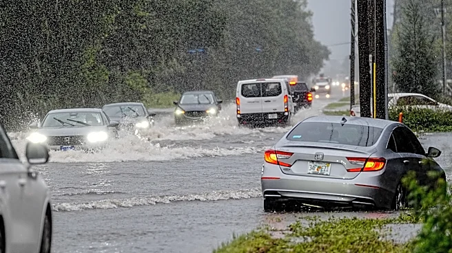
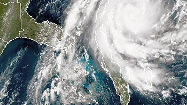
Brevard County, Florida, recently experienced severe flash flooding that resulted in two fatalities and significant damage to homes and infrastructure. This event is believed to be an early indicator of what could be a challenging fall and winter for
Florida due to a strengthening El Niño. According to Emily Powell, Florida State Climatologist at Florida State University, this El Niño is projected to become 'very strong,' potentially surpassing all previous El Niños on record since 1950 in terms of strength. The National Oceanic and Atmospheric Administration (NOAA) describes El Niño as a significant climate driver characterized by warmer water temperatures in the central and eastern Pacific. This phenomenon influences global weather patterns, including shifting the Pacific jet stream, which is expected to bring more winter storms and heavier rainfall to California and the southern United States, including Florida.
Why It's Important?
The anticipated 'very strong' El Niño carries significant implications for Florida, particularly concerning increased risks of heavy rainfall, flooding, and severe weather outbreaks. As Megan Borowski, senior meteorologist for the Florida Public Radio Emergency Network, noted, stronger winter storms associated with El Niño can produce higher rain rates over shorter periods, directly contributing to flash flooding. The recent '1,000-year flood' in Brevard County, where some areas received over 20 inches of rain in less than 24 hours, underscores the potential for extreme events. This poses substantial threats to public safety, property, and infrastructure, potentially leading to widespread disruptions, economic losses from damage, and increased demands on emergency services. The historical link between El Niño years and severe weather, such as the Central Florida tornadoes in the late 1990s, highlights the need for heightened preparedness.
What's Next?
As the El Niño is expected to reach its peak strength within the next month or so, Florida residents should prepare for a potentially record-wet winter and an increased likelihood of severe weather events. Experts advise residents to stay 'weather aware' and develop plans for potential evacuations, especially if they reside in flood-prone areas. Emergency management agencies will likely intensify public awareness campaigns and readiness efforts. Communities will need to assess and potentially reinforce their flood mitigation strategies. Furthermore, the potential for severe weather outbreaks, including tornadic events, means residents should identify safe shelter locations within their homes and workplaces. The ongoing monitoring by NOAA and the National Weather Service's Climate Prediction Center will provide crucial updates on the El Niño's progression and its specific impacts on regional weather patterns.
Beyond the Headlines
The impending 'very strong' El Niño and its projected impacts on Florida underscore broader climate-related challenges facing coastal regions in the U.S. While El Niño is a natural climate cycle, its interaction with long-term climate trends can exacerbate extreme weather events. The concept of a '1,000-year flood' occurring in Brevard County raises questions about the adequacy of current infrastructure and urban planning in the face of increasingly intense rainfall events. This situation highlights the critical need for long-term investments in resilient infrastructure, improved drainage systems, and advanced early warning technologies. It also prompts a deeper discussion about how communities can adapt to a future where extreme weather events may become more frequent and severe, influencing everything from insurance markets to public health strategies and emergency response protocols.