


What's Happening?
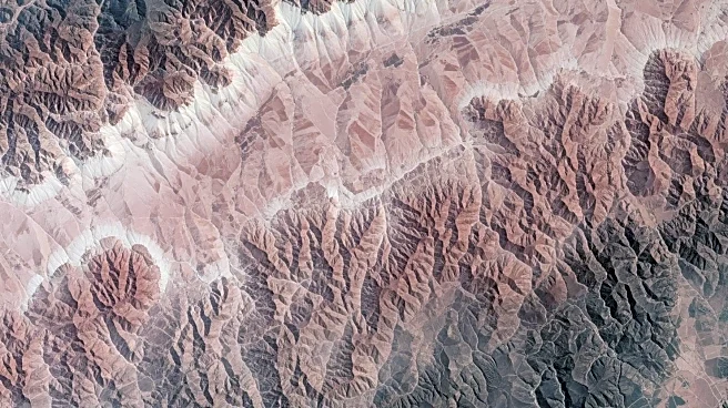
NASA and the U.S. Geological Survey's Landsat 9 satellite has captured high-resolution images of the Tarim Basin in western China, highlighting the convergence of desert winds and glacial meltwater. The satellite, launched in 2021, is equipped with advanced
sensors that allow scientists to monitor environmental changes across continents, including shrinking glaciers and shifting coastlines. The images reveal the Mazartagh Ridge, which acts as a natural barrier against the winds of the Takla Makan Desert, and the Hotan River, which sustains life in one of the world's most arid regions.
Why It's Important?
The Landsat 9 mission is crucial for tracking global environmental changes, providing valuable data for scientists studying climate dynamics and ecosystem shifts. The imagery from the satellite aids in understanding how natural barriers like the Mazartagh Ridge influence desert landscapes and how waterways like the Hotan River support biodiversity. This information is vital for developing strategies to manage water resources and mitigate the impacts of climate change, which can affect agriculture, water supply, and biodiversity conservation.