



What's Happening?
The National Oceanic and Atmospheric Administration (NOAA) has introduced new Flood Inundation Mapping (FIM) technology to improve how communities visualize and prepare for flood risks. This development comes after forecasters used terms like 'devastating'
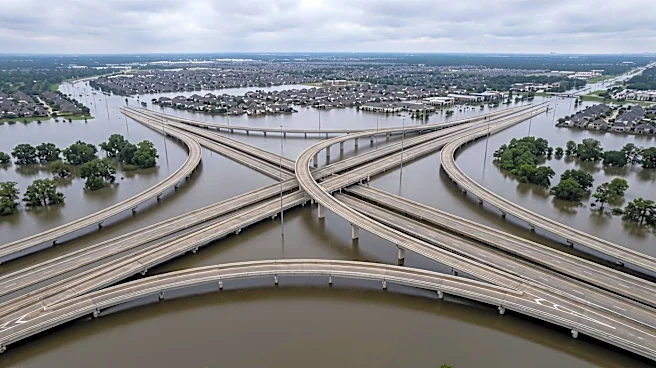
and 'catastrophic' to describe the expected impacts of Hurricane Helene, yet many community members reported being unprepared. Monica Youngman, Chief Scientist for NOAA’s National Weather Service, highlighted that despite warnings, the public often struggles to grasp the real-world implications of flood forecasts. The FIM service combines 3D visualizations with infrastructure data, including water treatment plants, power substations, highways, hospitals, and schools. This allows for a more concrete understanding of potential flood extents and their impact on critical infrastructure. Additionally, a new 'Cascading Impacts' product will translate future flood forecasts into specific local impacts, helping to identify who and what infrastructure are most likely to be affected.
Why It's Important?
This new technology is crucial for enhancing disaster preparedness and resilience across the United States. By providing clear, 3D visualizations of flood extents and their potential impact on infrastructure, communities can move beyond abstract warnings to tangible understanding. This improved clarity can lead to more effective pre-disaster planning, better allocation of resources, and more timely evacuations, ultimately saving lives and reducing property damage. For emergency managers, first responders, and federal agencies, the FIM and Cascading Impacts tools offer a more precise operational picture, enabling them to prioritize actions and communicate risks more effectively to the public. The ability to visualize the 'unimaginable' makes flood forecasts more actionable, fostering a proactive approach to disaster mitigation rather than a reactive one. This is particularly vital for areas prone to severe flooding, where understanding the specific vulnerabilities of local infrastructure is paramount.
What's Next?
NOAA and the National Weather Service will continue to integrate and expand the use of Flood Inundation Mapping and the Cascading Impacts product across more communities. The goal is to ensure that all communities receive early and clear warnings about the extent of flooding. This will involve ongoing collaboration with local partners, including emergency managers, first responders, and media, to effectively disseminate this enhanced information. Further improvements to existing disaster-focused models will also be pursued, requiring more data from networks of weather observation sites globally. The focus will be on refining these tools to provide even more accurate and localized forecasts, allowing for continuous improvement in disaster preparedness strategies and public awareness campaigns. The long-term objective is to make flood forecasts 'real' for everyone, enabling better decision-making before, during, and after flood events.
Beyond the Headlines
The introduction of advanced visualization tools like FIM represents a significant shift in how scientific data is communicated to the public and decision-makers. It addresses the inherent challenge of translating complex meteorological models into understandable and actionable information. This technological leap has broader implications for public trust in scientific institutions and their ability to protect communities from natural hazards. By making forecasts more relatable and impactful, NOAA is not only improving disaster preparedness but also fostering a more informed and engaged citizenry regarding climate risks. This approach could serve as a model for communicating other complex environmental threats, potentially leading to more proactive policy-making and community-level resilience building against a wider range of natural disasters. The ethical dimension of ensuring equitable access to and understanding of this technology across diverse communities will also be a critical consideration.