


What's Happening?
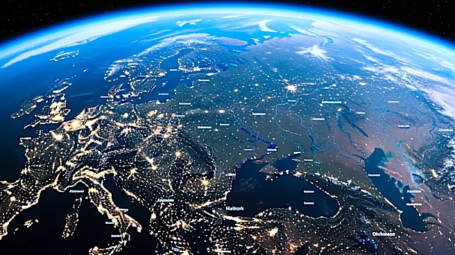
NASA has launched a new tool called 'Your Name in Landsat' that allows users to see their names spelled out using satellite imagery of Earth's landscapes. Released for Earth Day 2026, the tool uses an intelligent matching algorithm to find natural formations
that resemble letters. Users can type their names into the system, which then scans decades of satellite photographs to match each letter with a geographic feature such as mountains, rivers, or lakes. The tool draws from over 50 years of Landsat satellite data, managed jointly by NASA and the USGS, to create these personalized images. The initiative has quickly gained popularity on social media platforms like Instagram and Reddit, where users share their unique geographic name art.
Why It's Important?
This initiative highlights the intersection of technology, art, and environmental awareness. By using real satellite data to create personalized art, NASA is engaging the public in a novel way that promotes interest in Earth sciences and environmental conservation. The tool's release on Earth Day underscores its role in raising awareness about the planet's natural beauty and diversity. It also demonstrates the potential of satellite data to connect people with global landscapes, fostering a deeper appreciation for environmental stewardship. The viral success of the tool suggests a strong public interest in interactive and educational experiences that combine personal identity with planetary awareness.
What's Next?
As the tool continues to gain traction, NASA may expand its capabilities to include more detailed geographic features or additional customization options. The success of the 'Your Name in Landsat' tool could inspire similar projects that use satellite data for educational and artistic purposes. Additionally, the tool's popularity may encourage further public engagement initiatives by NASA and other scientific organizations, leveraging technology to promote environmental education and awareness. The ongoing interest in this tool could also lead to collaborations with educational institutions to incorporate it into curricula focused on Earth sciences and geography.
Beyond the Headlines
The 'Your Name in Landsat' tool not only serves as a fun and engaging activity but also highlights the importance of satellite data in understanding and preserving Earth's ecosystems. By making this data accessible and relatable, NASA is helping to demystify the science behind satellite imagery and its applications. This initiative could lead to increased public support for space and Earth observation programs, emphasizing the value of long-term data collection in addressing global environmental challenges. Furthermore, the tool's ability to connect personal identity with global landscapes may inspire a sense of global citizenship and responsibility towards environmental conservation.