
What's Happening?
The US National Weather Service (NWS) Wichita KS office serves as the primary source for weather forecasts, warnings, and observations for Central and Southeast Kansas. This office, identified by its station
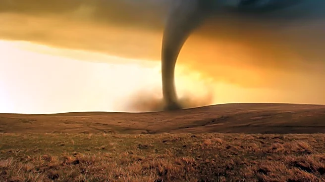
code ICT, operates 24/7, utilizing advanced satellite imagery and the KICT Doppler radar to monitor atmospheric conditions. Their mission is to protect life and property by issuing critical alerts such as Severe Thunderstorm Warnings, Tornado Warnings, and Flash Flood Statements, which are broadcast through emergency systems. Unlike generic weather applications, the NWS Wichita office is staffed by local meteorologists who possess specific knowledge of Kansas's unique geography and climatology, which is crucial during severe weather events, particularly in spring. Residents can access real-time updates and radar information via the official NWS Wichita website, which is mobile-optimized, and through their active presence on social media platforms like X (formerly Twitter) and Facebook for immediate 'nowcasts'. The office also provides detailed 7-day forecasts that include Meteorologist Discussions, explaining the rationale behind predictions, and Probability of Precipitation (PoP) percentages to aid in daily planning.
Why It's Important?
The NWS Wichita KS plays a vital role in public safety and daily life for millions in Kansas. Its localized expertise ensures that residents receive accurate and timely information tailored to the region's dynamic weather patterns, which are prone to rapid shifts and severe events. Understanding the distinction between a 'Severe Weather Watch' (conditions favorable for severe weather) and a 'Severe Weather Warning' (severe weather is occurring or imminent) is critical for public safety, enabling residents to take appropriate actions to protect themselves and their families. The data collected by the ICT station is also significant nationally, as it contributes to calibrating broader weather models, underscoring the importance of local meteorological work for the entire country's weather prediction accuracy. Furthermore, the NWS Wichita's collaboration with the Skywarn program, a network of trained volunteer storm spotters, provides crucial 'ground truth' information that complements radar data, enhancing the accuracy and effectiveness of warnings and strengthening community resilience against severe weather.
What's Next?
Residents of Central and Southeast Kansas should continue to rely on the US National Weather Service Wichita KS for ongoing weather updates, especially as severe weather seasons approach. The NWS Wichita office will maintain its 24/7 monitoring of weather conditions, issuing alerts and forecasts as needed. The office will likely continue to host free training sessions for the Skywarn program in Sedgwick, Butler, and Harvey counties, encouraging community participation in storm spotting to enhance local weather intelligence. As technology evolves, the NWS Wichita will likely continue to optimize its digital platforms for accessibility and real-time information dissemination. Residents are encouraged to regularly review their family emergency plans for tornadoes and floods, identify safe rooms in their homes, ensure Wireless Emergency Alerts (WEA) are enabled on smartphones, and bookmark the NWS Wichita (ICT) radar page for quick access during storms.
Beyond the Headlines
The operations of the US National Weather Service Wichita KS highlight the critical intersection of advanced scientific technology and localized human expertise in public safety. The daily launch of weather balloons (radiosondes) provides raw atmospheric data that feeds into global models, which are then interpreted by local meteorologists who factor in regional nuances like Wichita's 'urban heat island' effect. This blend of high-tech data and human experience underscores why the NWS remains the gold standard for local forecasting, demonstrating the irreplaceable value of human judgment in interpreting complex scientific data for practical, life-saving applications. The emphasis on community involvement through programs like Skywarn also illustrates a broader societal trend towards citizen science and collaborative efforts in disaster preparedness, empowering individuals to contribute to collective safety. This model of integrated scientific rigor, local knowledge, and community engagement is essential for regions facing increasing weather volatility due to climate change, ensuring that communities are not only informed but also actively involved in their own protection.