
What's Happening?
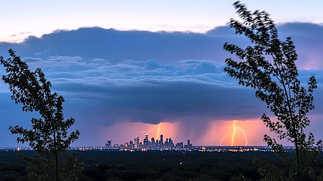
Pittsburgh is experiencing a weather pattern that includes a high chance of storms in the evening, particularly between 4 p.m. and 7 p.m. The day is expected to remain mostly dry until the afternoon, with
temperatures reaching a high of 81 degrees. The primary concerns with the incoming storms are strong winds, frequent lightning, and downpours. The storms are expected to move from the west to the east, with gusty winds reaching up to 25 mph. Following the storms, a break in the heat is anticipated on Friday, with temperatures dropping to the upper 70s. The weekend may bring more severe weather, including the possibility of straight-line winds, large hail, and tornadoes.
Why It's Important?
The potential for severe weather in Pittsburgh highlights the need for residents to stay informed and prepared for sudden changes in weather conditions. Strong winds and lightning can pose risks to safety and property, while heavy downpours may lead to localized flooding. The forecasted drop in temperatures after the storms could provide relief from the recent heat, but the possibility of severe weather over the weekend remains a concern. This situation underscores the importance of effective communication from weather services to ensure public safety and preparedness.
What's Next?
Residents should monitor weather updates and be prepared for possible severe weather over the weekend. Authorities may issue warnings or advisories if conditions worsen, and it is advisable for individuals to have emergency plans in place. The potential for severe weather, including tornadoes, requires vigilance and readiness to seek shelter if necessary. The cooler weather following the storms may bring a temporary respite, but the situation remains dynamic, with further developments expected.