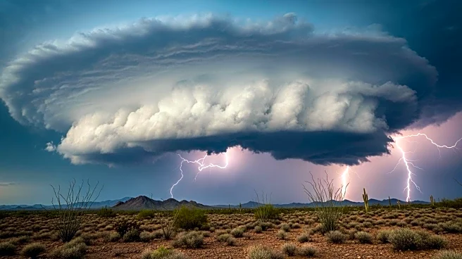

What's Happening?
Arizona and parts of the Southwest are under threat of flash floods due to remnants of Hurricane Priscilla and other weather systems. The National Weather Service has issued flood watches for areas including Phoenix and Flagstaff, with rainfall expected to exceed 2 inches in some locations. The moisture influx is not related to the monsoon season but is driven by tropical moisture from the Pacific. The Weather Prediction Center has placed central Arizona in a Level 3 flash flood threat, indicating significant risk.
Why It's Important?
The flash flood threat poses immediate risks to communities, including potential damage to infrastructure and disruption of daily life. However, the rainfall offers relief from the severe drought conditions affecting over 80% of the western U.S., which have led to crop losses and increased wildfire risks. The event highlights the complex interplay between weather patterns and environmental challenges, emphasizing the need for effective disaster preparedness and response strategies.
What's Next?
As the weather system progresses, authorities will continue to monitor flood risks and issue warnings as necessary. The prolonged wet weather is expected to lower fire risk levels and bring cooler temperatures to the region. Additional moisture from another system, Invest 90E, may further impact the area, potentially extending the period of rainfall and flood risk.
Beyond the Headlines
The situation underscores the broader implications of climate variability and the challenges it presents to water management and agricultural practices in drought-prone areas. It also raises questions about the adequacy of infrastructure to handle extreme weather events and the need for long-term planning to mitigate such risks.