


What's Happening?
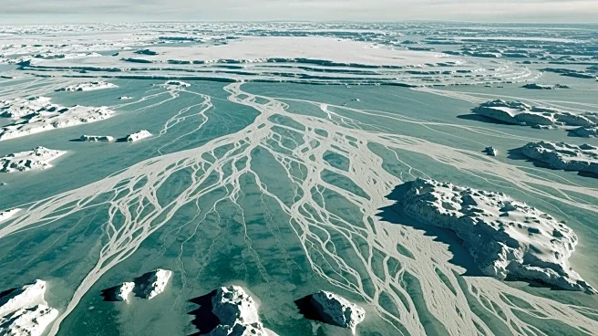
A team of international researchers has unveiled a detailed map of Antarctica's subglacial landscapes, providing unprecedented insights into the continent's hidden topography. Using a technique called Ice Flow Perturbation Analysis (IFPA) combined with
satellite data, the map reveals large mountain ranges, deep canyons, and wide valleys beneath the ice. This discovery is significant as it offers new data that could help scientists better understand the dynamics of the Antarctic Ice Sheet, which holds about 70% of the Earth's freshwater. The findings could also inform predictions about future sea level rise, as the subglacial topography plays a crucial role in the movement and melting of ice.
Why It's Important?
Understanding the subglacial topography of Antarctica is vital for predicting how the ice sheet will respond to climate change. The newly mapped landscapes can influence the flow of ice and its stability, affecting global sea levels. As the Antarctic Ice Sheet melts, it contributes to rising sea levels, which pose a threat to coastal cities worldwide. This research provides a critical tool for scientists to focus future surveys and improve models that predict sea level changes. The map's detailed insights into previously uncharted regions of Antarctica could lead to more accurate assessments of the potential impact of climate change on global sea levels.
What's Next?
The new map will guide future scientific surveys in Antarctica, helping researchers target areas that are critical for understanding ice dynamics. Scientists will use this data to refine models of ice flow and melting, improving predictions of sea level rise. The research team plans to continue using satellite observations to monitor changes in the ice sheet and its underlying topography. As climate change progresses, ongoing studies will be essential to assess the stability of the Antarctic Ice Sheet and its potential impact on global sea levels.