


What's Happening?
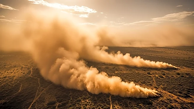
A significant dust storm swept through West Texas and the Panhandle on March 15, 2026, driven by a strong cold front. The storm, characterized by high winds and dry conditions, reduced visibility and increased the risk of wildfires. NASA's Aqua satellite
captured images of the dust cloud, which led to hazardous travel conditions and a multivehicle crash in North Texas. The National Weather Service issued a Red Flag Warning due to the combination of high winds, low humidity, and dry fuels, which resulted in several wildfires in the Panhandle. The weather station in Pecos recorded a temperature drop from 88°F to 39°F as the cold front passed, with wind gusts reaching up to 64 kilometers per hour.
Why It's Important?
The dust storm highlights the vulnerability of regions like West Texas to extreme weather events, particularly during periods of drought. Such conditions not only pose immediate risks to transportation and safety but also exacerbate the potential for wildfires, which can have devastating effects on local communities and ecosystems. The event underscores the importance of monitoring and preparing for weather-related hazards, especially in areas prone to drought and high winds. The ability to predict and respond to these events is crucial for minimizing damage and ensuring public safety.
What's Next?
As the region continues to experience drought conditions, the likelihood of similar dust storms and wildfires remains high. Authorities may need to enhance their preparedness and response strategies to mitigate the impact of future events. This could involve improving early warning systems, increasing public awareness, and implementing measures to reduce fire risks. Additionally, ongoing monitoring by satellites and weather stations will be essential in providing timely data to inform decision-making and emergency response efforts.