


What's Happening?
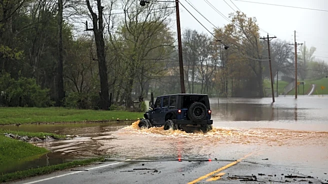
A significant severe weather system is currently impacting the central United States, placing over 25 million people at risk. The National Weather Service (NWS) has issued warnings about the potential for damaging storms, large hail, and flash flooding
as the system moves eastward through the Plains. This weather event is part of an active severe weather season that has already seen high tornado activity in the Midwest. The system is driven by a combination of a dip in the jet stream, warm temperatures, and moisture from the Gulf, leading to severe thunderstorms capable of producing large hail, damaging winds, and isolated tornadoes. The threat is expected to persist for several days, with disturbances triggering new storms each afternoon and evening.
Why It's Important?
The ongoing severe weather poses significant risks to public safety and infrastructure across a large portion of the U.S. The potential for flash flooding and tornadoes could lead to disruptions in travel and daily life, as well as damage to homes and businesses. The economic impact could be substantial, particularly in agriculture and transportation sectors, which are vulnerable to such weather conditions. Additionally, the frequency and intensity of these weather events may be indicative of broader climate patterns, raising concerns about preparedness and resilience in affected regions.
What's Next?
As the weather system continues to move, the threat will shift eastward into parts of the Midwest. States such as Nebraska, Kansas, Iowa, Minnesota, and Missouri are expected to experience severe weather as the system progresses. Residents in these areas are advised to stay alert and prepared for rapidly changing conditions. Emergency services and local governments may need to respond to potential flooding and storm damage, emphasizing the importance of community preparedness and effective communication during such events.