
What's Happening?
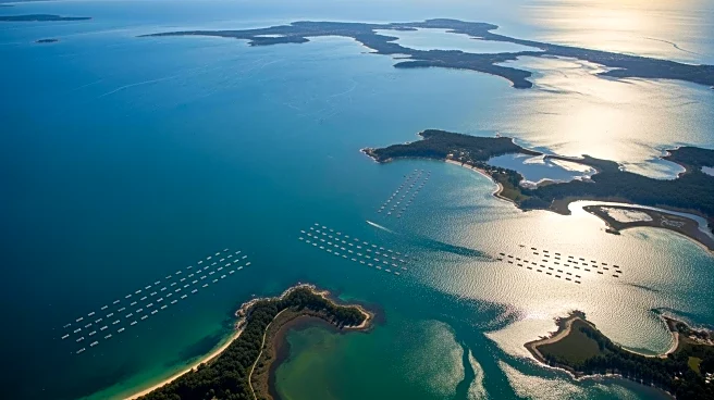
NASA's satellite data is being utilized by oyster farmers in Maine to select optimal sites for oyster farming. Luke Saindon, director of The World Is Your Oyster farm, used NASA's satellite maps to identify
a suitable location for his farm, which has thrived over the past four years. The data, collected by NASA's Landsat satellites, provides information on water temperatures and food levels, crucial for oyster growth. This approach is part of a study led by University of Maine scientists, demonstrating how satellite data can predict oyster growth rates. The study uses temperature data from Landsat and food availability estimates from European Sentinel-2 satellites to model oyster growth, helping farmers make informed decisions about seeding and harvesting.
Why It's Important?
The use of NASA's satellite data represents a significant advancement in aquaculture, offering a scientific basis for site selection that can lead to more sustainable and profitable oyster farming. This method reduces financial risks for farmers by providing insights into optimal growth conditions, potentially increasing the industry's value, which has already seen a 78% increase from 2011 to 2021. As the aquaculture sector grows, such data-driven approaches are essential for maximizing yield and sustainability, supporting local economies, and ensuring environmental stewardship.
What's Next?
The University of Maine team is developing an online tool to make this model accessible to more farmers, allowing them to estimate growth rates and plan their operations more effectively. This initiative could lead to broader adoption of satellite data in aquaculture, enhancing productivity and sustainability. Additionally, the PACE satellite, launched in 2024, will provide more detailed observations, potentially identifying specific plankton species, further refining site selection and management practices.