


What's Happening?
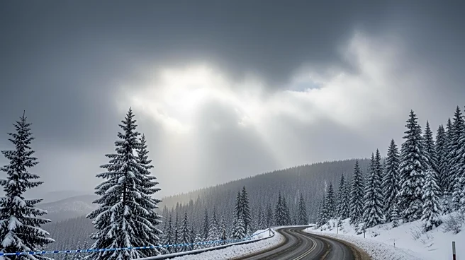
The National Weather Service has issued a winter storm watch for Northern California, warning travelers of significant snow accumulations in the Sierra Nevada and surrounding areas. The advisory comes as many prepare to travel for the Presidents Day weekend.
Meteorologist Dakari Anderson from the Sacramento office highlighted that the best travel window is from Saturday through Sunday morning before the storm intensifies. Communities at elevations between 3,000 to 4,000 feet are expected to receive 1 to 2 feet of snow, while higher elevations could see up to 8 feet. The storm is anticipated to affect parts of western Nevada and southern Oregon as well. Local authorities, including the Shasta County Sheriff's Office, have urged residents to prepare for potential road closures and whiteout conditions.
Why It's Important?
The winter storm watch is significant as it coincides with a major holiday weekend, potentially disrupting travel plans for many. The Sierra Nevada region, known for its ski resorts, is a popular destination, and the storm could impact tourism and local economies reliant on holiday visitors. Additionally, the storm poses safety risks, with authorities advising extreme caution due to possible hazardous driving conditions. The broader impact extends to neighboring states, highlighting the interconnected nature of regional weather events and their potential to affect multiple areas simultaneously.
What's Next?
Travelers are advised to monitor weather updates and plan their journeys accordingly. Local governments and emergency services are likely to remain on high alert, ready to respond to any emergencies or road closures. The storm's progression will be closely watched, with potential adjustments to travel advisories as conditions evolve. Residents and businesses in affected areas may need to prepare for extended disruptions, particularly if the storm's impact is severe.