


What's Happening?
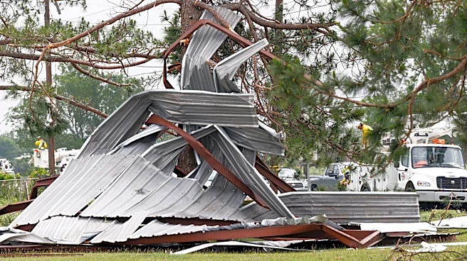
North Texas is preparing for another round of severe weather after experiencing deadly tornadoes over the weekend. Two tornadoes, classified as EF-2 and EF-1, struck the region, resulting in two fatalities in Parker and Wise counties. The EF-2 tornado in Runaway
Bay reached maximum winds of 135 mph, while the EF-1 tornado in Springtown had winds up to 105 mph. The area is now facing the threat of additional storms, including potential hail and strong winds, expected to return on Tuesday. The weather forecast predicts warm and humid conditions, with temperatures reaching 92 degrees on Monday, followed by rain and thunderstorms that could persist through the weekend.
Why It's Important?
The return of severe weather poses significant risks to the residents of North Texas, who are still recovering from the recent tornadoes. The potential for further damage and disruption is high, as the region could experience additional property damage, power outages, and transportation issues. The situation underscores the importance of emergency preparedness and the need for effective communication from local authorities to ensure public safety. The economic impact could also be substantial, affecting local businesses and infrastructure. The ongoing threat highlights the challenges of climate-related weather patterns and the necessity for resilient community planning.
What's Next?
Residents in North Texas are advised to stay informed about weather updates and heed warnings from local authorities. Emergency services are likely to remain on high alert, ready to respond to any incidents resulting from the upcoming storms. Community leaders may need to coordinate relief efforts and provide support to those affected by the previous tornadoes. The situation may prompt discussions on improving infrastructure resilience and emergency response strategies to better handle future severe weather events.