






What's Happening?
A potential nor'easter is forecast to bring rain, wet snow, and strong winds to the Northeast and Great Lakes regions later this week and into the weekend. This weather event is accompanied by a significant cold air mass settling across the eastern United
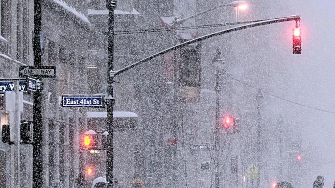
States. A deep southward plunge in the jet stream, known as a trough, is expected to carve across the East, causing daytime high temperatures to plummet by 20 degrees Fahrenheit from Wednesday to Friday, affecting areas from Chicago to Atlanta. By the weekend, low temperatures could drop into the 30s as far south as the Florida Panhandle. A low-pressure system will develop across the Midwest by Wednesday and intensify as it moves into the Ohio Valley Wednesday night, bringing rainfall from Georgia to Michigan. By Thursday night, another low-pressure area is anticipated to form off the Eastern Seaboard, potentially leading to rain mixing with or changing over to wet snow in parts of the interior Northeast.
Why It's Important?
This developing nor'easter and accompanying cold snap pose significant challenges for millions across the eastern U.S. The combination of rain, wet snow, and gusty winds can lead to hazardous travel conditions, potential power outages, and disruptions to daily life. While major metropolitan areas along the I-95 corridor, including Philadelphia, New York City, and Boston, are expected to primarily experience widespread rain due to warmer ground temperatures, higher elevations in the interior Northeast and areas around the Great Lakes could see accumulating snow. The sudden drop in temperatures, marking the coldest air in months for many, necessitates preparedness for residents, particularly concerning heating and potential freezing conditions. The uncertainty in the storm's exact track and intensity highlights the need for continuous monitoring and readiness from weather authorities and the public.
What's Next?
Forecasters indicate that the best chances for accumulating snow will be in the mountains of northern New England, upstate New York, and the Appalachians. The National Weather Service suggests that some areas could see at least one inch of snow, though the exact placement and amount remain uncertain. For cities along the I-95 corridor, significant snowfall is considered highly unlikely due to warm ground temperatures and a lack of deep cold air. However, gusty winds and coastal flooding at high tide remain a possibility for parts of the East Coast, from the northern Outer Banks of North Carolina to New England, depending on the storm's proximity to the coast. Residents are advised to stay updated on local forecasts as models continue to refine the storm's trajectory and impacts over the coming days.
Beyond the Headlines
The term 'nor'easter' often evokes images of severe winter storms, but its definition is simply an area of low pressure off the East Coast bringing winds from the northeast. This event, while potentially impactful, also serves as a reminder of the meteorological nuances that determine a storm's severity and type of precipitation. The distinction between coastal cities receiving rain and interior regions experiencing snow highlights the microclimates and geographical factors that influence weather patterns. Furthermore, the forecast of a deep southward plunge in the jet stream underscores the dynamic nature of atmospheric circulation and its direct influence on regional temperatures and storm tracks. This event could also prompt discussions on urban planning and infrastructure resilience in the face of increasingly variable weather conditions, particularly concerning drainage systems and power grid stability.