


What's Happening?
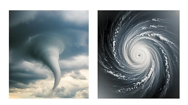
Stunning footage has revealed the interior of Hurricane Melissa's massive eye as it approaches Jamaica with nearly 200 mph winds. The Category 5 storm is poised to crash head-on into Jamaica by Tuesday morning, marking the strongest storm to hit the island
since records began in 1850. Melissa has already resulted in three deaths and more than a dozen injuries related to the storm. The hurricane is expected to cause catastrophic flooding and numerous landslides across the island, with rain totals potentially reaching up to 40 inches.
Why It's Important?
The impact of Hurricane Melissa on Jamaica is expected to be devastating, with the potential for widespread destruction and displacement. The storm's intensity raises concerns about the increasing frequency and strength of hurricanes due to climate change, which exacerbates heavy rains and flooding. The economic implications are significant, as the storm could lead to substantial infrastructure damage and long-term recovery efforts. The footage of the storm's eye highlights the power and scale of the hurricane, underscoring the need for improved disaster preparedness and climate adaptation strategies.
What's Next?
Melissa is expected to make landfall in Jamaica on Tuesday morning, with catastrophic conditions anticipated. The storm will then move towards Cuba, where preparations are underway to mitigate its impact. The international community may be called upon to assist in recovery efforts, and disaster response teams will likely be involved in providing aid to affected regions. The focus will be on ensuring the safety of residents and minimizing the storm's impact on infrastructure and the economy.
Beyond the Headlines
The storm's impact on Jamaica's mountainous regions could lead to more severe flooding and landslides, posing additional risks to communities. The resilience of the Jamaican people will be tested as they face potential displacement and loss of life. The storm also underscores the need for improved disaster preparedness and climate adaptation strategies in the Caribbean, as extreme weather events become more frequent and intense.