


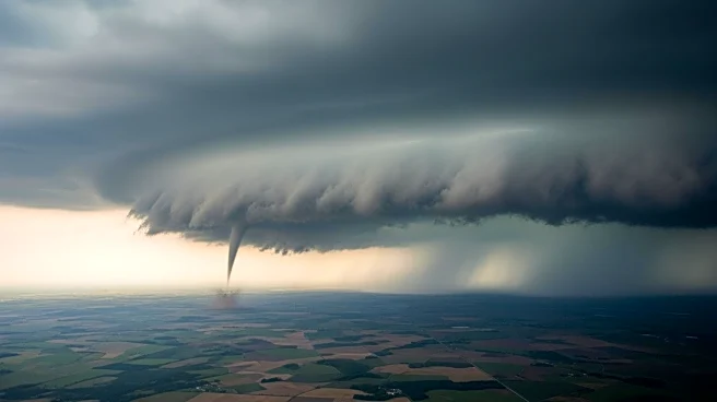

What's Happening?
Following a series of destructive tornadoes and large hail in the Midwest, the severe weather threat is shifting eastward. The storms, which included a supercell that tracked from Illinois to Indiana, caused significant damage, including grapefruit-sized
hailstones. As the weather system moves, heavy thunderstorms are expected across the Midwest, with flood watches in effect for northern Indiana, Michigan, and northwest Ohio. The risk of tornadoes is increasing again with daytime heating, adding instability to the atmosphere. The severe weather threat zone now extends from Texas to Pennsylvania, with concentrated activity expected in the Ohio Valley, Mid-Atlantic, and parts of the Deep South.
Why It's Important?
The shift of severe weather eastward poses a continued threat to densely populated areas, potentially affecting millions of residents. The risk of tornadoes, damaging winds, and hail could lead to further property damage, power outages, and disruptions to daily life. The ongoing severe weather highlights the challenges of predicting and preparing for such events, emphasizing the importance of timely warnings and effective emergency response systems. The situation also underscores the role of climate factors, such as the marine heat wave in the Gulf of Mexico, in fueling severe weather patterns.
What's Next?
As the cold front associated with the storm system moves east, additional strong-to-severe storms are expected to develop. Authorities are likely to maintain heightened alert levels and continue issuing warnings as necessary. Emergency services will need to be prepared for potential impacts, including power outages and infrastructure damage. The weather system is expected to clear the East Coast by Thursday, reducing the immediate threat of severe weather. However, the focus will shift to recovery efforts in affected areas and assessing the broader implications of the storm system.