





What's Happening?
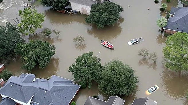
A study conducted in Harris County, Texas, is examining the effectiveness of current green infrastructure prioritization methods, particularly concerning flood-exposed homes. The research highlights a potential discrepancy where neighborhood-level indicators,
while practical, may not accurately identify areas most in need of green infrastructure investment. Specifically, neighborhoods that appear to have sufficient vegetation overall might still contain concentrated clusters of homes vulnerable to flooding, surrounded by heavily developed land. The study aims to determine if assessing conditions around individual flood-exposed buildings can uncover needs that are overlooked when prioritization is based solely on broader neighborhood-level screening. This analysis integrates residential building records, flood exposure estimates at the building level, land-cover data, and social vulnerability indicators from census tracts. By comparing prioritization based on tract-wide measurements with an approach that considers vegetation and impervious cover immediately surrounding flood-exposed residences, the study seeks to refine how cities identify areas for green infrastructure investment.
Why It's Important?
This research is significant because it challenges conventional approaches to urban planning and flood mitigation strategies in the U.S. If neighborhood-level assessments are indeed missing critical areas of vulnerability, then current green infrastructure investments may not be optimally protecting communities. The study's findings could lead to a re-evaluation of how cities, particularly those prone to flooding like Houston in Harris County, allocate resources for environmental resilience. By identifying a more granular approach to prioritization, the research could help ensure that green infrastructure projects are directed to the most impactful locations, potentially saving homes and lives from flood damage. This shift in perspective could also influence policy-making at local and state levels, encouraging more targeted and equitable distribution of environmental benefits, especially for socially vulnerable neighborhoods that might be disproportionately affected by flooding.
What's Next?
The ongoing study will continue to assess how different selection thresholds and weighting methods influence priority locations for green infrastructure. It will also evaluate changes in the number and spatial concentration of exposed homes included or omitted from prioritization, as well as the representation of exposed homes in socially vulnerable neighborhoods. The ultimate goal is to develop a framework that supports more targeted follow-up assessments. This framework will aim to avoid equating general vegetation availability with actual flood protection and will not assume that identified areas are automatically suitable for specific interventions. The results are expected to inform urban planners and policymakers in Harris County and potentially other flood-prone regions across the U.S. on how to better identify and address flood risks through more precise green infrastructure planning.
Beyond the Headlines
The implications of this study extend beyond immediate flood mitigation to broader questions of environmental justice and equitable urban development. If current prioritization methods inadvertently overlook vulnerable populations or specific pockets of risk, it could exacerbate existing inequalities. The research highlights the ethical imperative for urban planning to be precise and inclusive, ensuring that the benefits of green infrastructure are distributed fairly and effectively. It also underscores the complexity of environmental challenges in urban settings, where macro-level data can obscure micro-level realities. This work could catalyze a shift towards more data-driven, localized approaches in environmental planning, prompting a deeper examination of how spatial aggregation influences policy outcomes and who ultimately benefits or is left behind in urban resilience efforts.