


What's Happening?
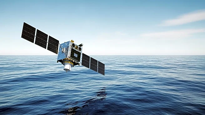
On November 16, 2025, the Sentinel-6B satellite was launched from Vandenberg Space Force Base in California. This mission is a collaborative effort between NASA, the National Oceanic and Atmospheric Administration (NOAA), and European partners including
the European Space Agency (ESA) and the European Organisation for the Exploitation of Meteorological Satellites (EUMETSAT). The satellite aims to continue the ocean height data record initiated in 1992 with the TOPEX/Poseidon mission. Sentinel-6B, along with its predecessor Sentinel-6A, forms part of the Sentinel-6/Jason Continuity of Service mission, which will provide continuity with past missions. The satellite is equipped with advanced instruments to measure ocean height, atmospheric temperatures, and other critical data, contributing to weather prediction and climate monitoring.
Why It's Important?
The launch of Sentinel-6B is significant for climate science and weather forecasting. By extending the ocean height record, the satellite provides crucial data for understanding sea level rise, ocean currents, and climate phenomena like the El Niño-Southern Oscillation (ENSO). This information is vital for predicting storm intensities and understanding long-term climate trends. The data collected will aid scientists and policymakers in making informed decisions about climate change mitigation and adaptation strategies. The mission underscores the importance of international collaboration in addressing global environmental challenges.
What's Next?
Sentinel-6B will continue to collect data through the end of the 2020s, providing a nearly 40-year record of ocean height changes. This data will be used by a global community of scientists and forecasters to enhance weather prediction models and improve our understanding of oceanic and atmospheric processes. The mission's findings are expected to influence future climate policies and strategies for managing the impacts of sea level rise and extreme weather events.