


What's Happening?
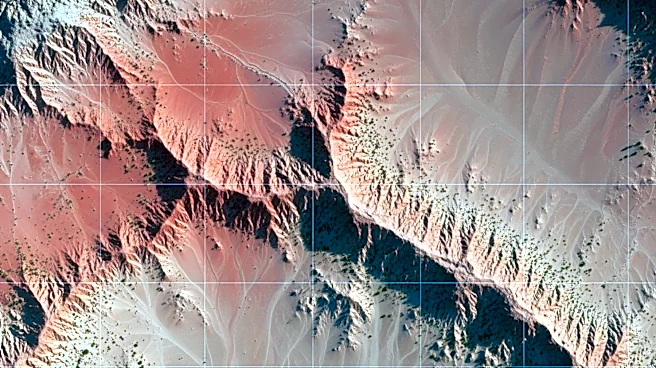
NASA and the U.S. Geological Survey (USGS) have teamed up to conduct mineral mapping in California's Mojave Desert. The initiative, part of the Geologic Earth Mapping Experiment (GEMx), aims to identify critical mineral deposits using advanced airborne
remote sensing technology. A NASA sensor detected a topaz deposit, which could indicate the presence of valuable porphyry copper deposits. This collaboration involves geoscientists conducting fieldwork to verify sensor data and collect samples. The project utilizes the Airborne Visible Infrared Imaging Spectrometer (AVIRIS) to analyze mineral compositions from high altitudes, contributing to a comprehensive mineral mapping effort across the Western U.S.
Why It's Important?
The discovery and mapping of critical minerals are vital for various industries, including electronics and renewable energy. Copper, in particular, is essential for electrical wiring and infrastructure. By identifying new mineral sources, the project supports the U.S. economy and reduces dependency on foreign mineral imports. The collaboration between NASA and USGS also showcases the application of space technology in Earth sciences, enhancing the understanding of geological processes and resource management. This initiative could lead to more efficient mining practices and sustainable resource utilization.
What's Next?
The GEMx project will continue to explore potential mineral deposits across the American West. Future steps include detailed ground investigations and the use of ground-penetrating equipment to confirm the presence of porphyry copper deposits. The data collected will inform further research and potential mining operations. The project is part of a broader effort to modernize mineral mapping and support sustainable resource management, with ongoing collaboration between federal agencies, state geological surveys, and private industry.