



What's Happening?
Washington D.C. is anticipating a mild and wet winter for 2026-27, driven by a historically strong 'Super El Niño' event in the tropical Pacific Ocean. This phenomenon is expected to strengthen the subtropical jet stream, leading to an active storm track
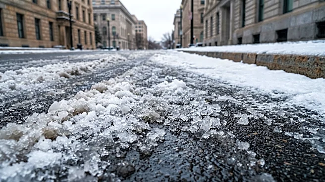
across the southern U.S. and up the East Coast. Temperatures are projected to be 2 to 4 degrees Fahrenheit above normal, potentially making it one of D.C.'s top-10 warmest winters on record. Precipitation is also expected to be above average, with forecasts of 10 to 13 inches of liquid precipitation, compared to the winter average of 8.89 inches. Despite the overall mild outlook, the active storm track increases the risk of blizzards, similar to past strong El Niño winters like 1982-83 and 2015-16, which saw significant snow events. Overall snowfall is predicted to be below normal, ranging from 6 to 12 inches, but with fewer, potentially more intense, snow events.
Why It's Important?
The forecast for a mild, wet winter with elevated blizzard risk in Washington D.C. has significant implications for urban planning, public services, and daily life. Warmer temperatures could reduce energy consumption for heating, benefiting residents and businesses. However, increased precipitation, coupled with the potential for intense, short-duration snow events, poses challenges for city infrastructure, including drainage systems and transportation networks. The 'boom or bust' nature of snowfall, with fewer but potentially larger events, requires adaptable emergency response strategies. Businesses reliant on consistent winter weather, such as those in outdoor recreation, might face disruptions. The forecast also highlights the ongoing need for climate resilience planning in a major metropolitan area, as extreme weather events become more probable even within broader trends of warming.
What's Next?
The winter season in Washington D.C. is expected to feature alternating periods of mild weather and brief, intense cold air outbreaks. While the overall trend is towards warmer temperatures and more rain, the timing of cold air with an active southern storm track could lead to significant snowfall. The forecast suggests fewer opportunities for snowfall compared to an average winter, with the average number of measurable snowfall days potentially cut in half during strong El Niño years. However, if cold air aligns with moisture, the amount of snow from each event could be substantial. The European and American climate models indicate a risk of colder conditions in late winter, along with favorable storm tracks, suggesting that the latter part of the season might hold the highest potential for significant snow events. Residents and city officials should prepare for a winter that could be both mild and prone to sudden, severe weather. The El Niño is expected to peak in strength during early winter and gradually weaken, but its influence will likely persist throughout the season.
Beyond the Headlines
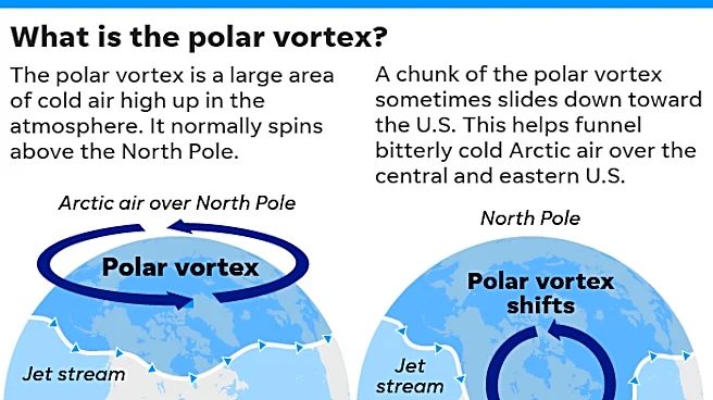
The strong El Niño event in Washington D.C. underscores the complex interplay between global climate patterns and localized weather impacts. The forecast of a mild winter with a heightened risk of blizzards illustrates how climate variability can lead to seemingly contradictory outcomes. This 'boom or bust' scenario for snowfall challenges traditional winter preparedness models, requiring a more nuanced approach that accounts for both overall warming trends and the potential for extreme, short-lived events. The discussion also touches upon the influence of other atmospheric phenomena, such as the Quasi-Biennial Oscillation (QBO) and solar activity, on the polar vortex and the likelihood of cold air outbreaks. This highlights the intricate web of factors that determine regional weather, emphasizing the need for advanced meteorological research and forecasting to better anticipate and adapt to future climate conditions.