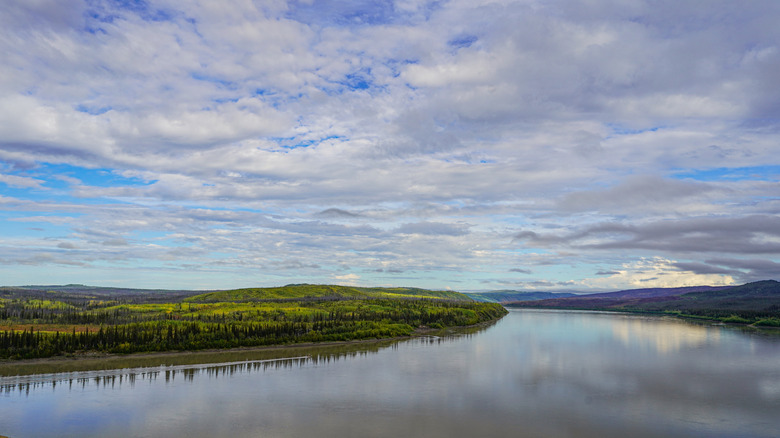
Alaska is the land of extremes, so it's no surprise that its longest river, the massive Yukon, is the third longest in the U.S. after the Missouri and the Mississippi. Originating at the Llewellyn Glacier
in Canada, the Yukon stretches for almost 2,000 miles, winding its way primarily through Alaska (home to 1,267 of those miles) before ending in the Bering Sea. Its name means "mighty river" in the Gwich'in language of the Indigenous Athabaskans, who for millennia have inhabited this area (along with other Native people).
It's a mighty river indeed, whose waters have sculpted and shaped the Alaskan landscape over millions of years. The river also served as a lifeline for the first humans who stepped foot on the North American continent more than 20,000 years ago, after coming over from Siberia via land or water. Later, the Yukon River evolved into a transportation artery, bringing thousands of eager (or frenzied, depending on who you ask) prospectors into Alaska to search for gold during the late 19th-century Klondike Gold Rush.Remnants of this historical event are still visible around the river.
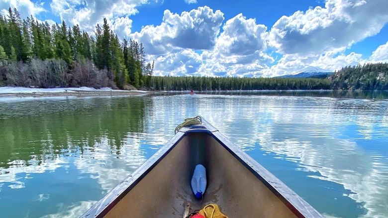
As impressive as the river's human history is its natural one, which you can experience first-hand when you take a trip down the powerhouse river as it travels through Alaskan landscapes of otherworldly beauty. Towering bluffs and thick boreal forests form the surrounding landscape; in some places the cliffs are over 1,000 feet high. Whether you prefer to kayak, canoe, or fish, this one-of-a-kind destination is perfect for water sports aficionados looking for the adventure of a lifetime. After all, this is the Last Frontier, where you can take your pick of diverse scenic landscapes and endless possibilities for outdoor adventures.
Read more: The 5 Most Alligator-Filled Destinations In All Of Florida
The Distinctive Features Of The Yukon River
The Yukon is a glacial-fed river, meaning it's affected by changes in the glaciers that drain into it. If you explore the Yukon in the summer, you might notice it's a cloudy, brownish color, a result of the silt deposits from glacial melt. Not only that, if you put your ear close to it, you'll hear a distinctive hiss like air going out of a tire, which is the sound of all that sediment sliding against the rocks and the river bed as the water moves. In the winter, the Yukon is clearer, mirroring the ice blue of the glaciers, and parts of it will freeze over, too.
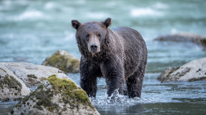
Some areas, like the 115 miles of the river contained within the Yukon-Charley Rivers National Preserve in central eastern Alaska, are tamer, perfect for canoeing, kayaking, rafting, boating, and fishing. Many first-timers to the Yukon begin by floating the river from Eagle to Circle, a 158-mile journey that takes about five days. This trip requires camping in the remote wilderness, which is home to peregrine falcons, bears, and moose.You may even see some of these animals swimming in the river.
As you float, you can take in the views of Alaska's lush stretches of spruce, pine, and fir trees mixing in with colorful birch and poplar trees, all part of the boreal forests that make up 27% of the total forest area on our planet. Striped layers of sandstone, jagged limestone cliffs, colorful volcanic bluffs, and other geologic features speak to 600 million years of geological processes here, creating an unforgettable scene along this dynamic body of water.
How To Get To The Yukon River
Considering its length, you might think there would be hundreds of places to access the Yukon River. But this is Alaska, and they don't call it the Last Frontier for nothing. As with most places in the state, reaching remote, wild beauty takes a bit of effort. A good way to get to the Yukon River is to head to the Yukon-Charley Nature Preserve by flying from Fairbanks, Alaska to the town of Eagle, which takes about an hour and 15 minutes. Alternatively, it's possible to drive from Fairbanks to either Eagle or Circle, if you are up for taking a scenic and adventurous roadtrip through Alaska's breathtaking backcountry. The drive to Eagle is 372 miles, whereas the trip to Circle is shorter (155 miles). Note that a 4WD is necessary for the very rough drive into Circle.
Another notable point along the Yukon River is the village of Emmonak, situated just above the mouth of the river. This is where many people end their long-distance boat trips. This location has an airport with direct flights to Bethel, Alaska, as well as non-direct flights to Anchorage. Galena is another access point on the Yukon River, although it's not reachable by road. Instead, you have to fly there on a regional flight or air taxi from Fairbanks or Anchorage.
The Dalton Highway, a 414-mile gravel and dirt road that travels from Livengood to Prudhoe Bay, has a bridge that crosses the Yukon River. The E.L. Patton bridge, also known as the five-mile bridge by locals, is a three-hour drive from Fairbanks and offers another jumping-off point for exploring the river. Of course, if you're really feeling adventurous, you can sign up for the Yukon 1000, the world's longest paddling race, which spans 1000 miles, starting from the historic gold rush town of Whitehorse in Canada and ending at the Dalton Highway Bridge.
Ready to discover more hidden gems and expert travel tips? Subscribe to our free newsletter for access to the world's best-kept travel secrets.
Read the original article on Islands.