Spain's a hiking mecca just like the Italian Dolomites and the high French Alps. Yep, the land of tapas and flamenco has oodles of spots where putting on your boots promises stacks of "wow" moments. There
are the glacier views and waterfalls of the Ordesa y Monte Perdido National Park. Or you can stroll through the magical region of Galicia known for its waterfalls and fairy forests. And then there's what's been called the "Grand Canyon of Spain," a great cleft cut out of the jagged Picos de Europa Mountain Range in the north of the country.
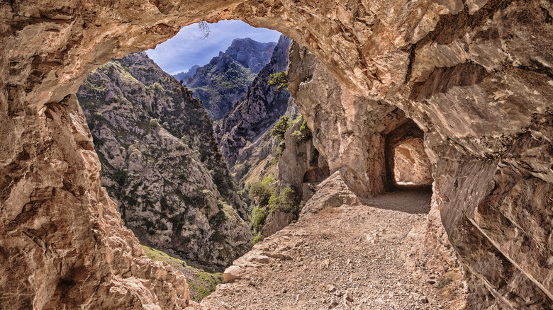
Prepare to be stunned when you lay eyes on it. Carving through peaks that soar more than 6,500 feet above sea level, the gorge runs for 7.5 miles from end to end. The whole thing is buttressed by big slabs of stone and has a river gushing below, waterfalls dropping from various angles, and daring resident mountain goats. Plus, the legendary Ruta del Cares hiking route follows the course of the canyon from top to bottom, clinging to precipitous cliffs and passing through old rock tunnels.
The breathtaking, vertigo-inducing trek begins at either one of the two villages that lie at opposite ends of the gorge. If you plan on walking it north to south, head for Poncebos, which is about a 1.5-hour drive from the city of Santander, a stunning and affordable beach city known for its food scene. To go south to north, make for the town of Caín de Valdedón, which is about a 2.5-hour drive from the city of Leon. Generally speaking, the north side is more accessible since it's closer to bigger airports along the coast in Santander and Bilbao, but hiking from the south is easier on the legs.
Read more: European Destinations That Are Best To Visit In December
Hiking One Of Spain's Most Epic Trails
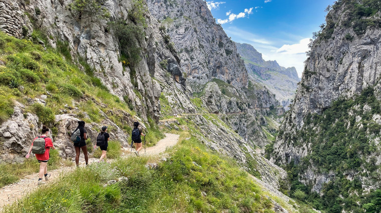
The Ruta del Cares clocks up a thigh-burning over 7 miles each way. It's a point-to-point trek, so you'll either have to zip up and down it in one pretty hefty hiking session or organize transport back to where you left your car. Either way, it's a challenge, clocking up over 3,600 feet of elevation difference on rough, highly exposed mountain terrain.
Starting in the hamlet of Poncebos, the route quickly meets the great canyon itself and proceeds along a gravity-defying ledge. Here, you'll be able to hear a river roaring far below and peer up to see the twisted summits of the scenic Picos de Europa (one of Europe's prettiest national parks). Soon, the path begins to gradually descend, passing old sheep farms and abandoned houses deep in the mountains, cutting through shadowy tunnels chipped straight out of the cliffs.
The route's a popular one and will likely get busy on key holiday dates and weekends. Spring is often said to be the best time to complete the hike, as the flora of the high peaks is at its best and the river waters are in full flow. Always be sure to pack good sunscreen and wear appropriate shoes for long stretches on uneven surfaces.
Ready to discover more hidden gems and expert travel tips? Subscribe to our free newsletter for access to the world's best-kept travel secrets.
Read the original article on Islands.