Here are a few things that Texas is famous for: barbecue, rodeos, and the Dallas Cowboys. Perhaps unsurprisingly, the Lone Star State is less famous for its mountains. The truth is, the bulk of Texas features
rolling plains and ranches that seem to go on for as far as the eye can see. But there are indeed some peaks in this corner of the country, albeit tucked into the far western part of the state. There are even scenic drives through the Texas highlands featuring views that can live up to even the most stunning and storied road trips in the U.S. Cue the Davis Mountains Scenic Loop.
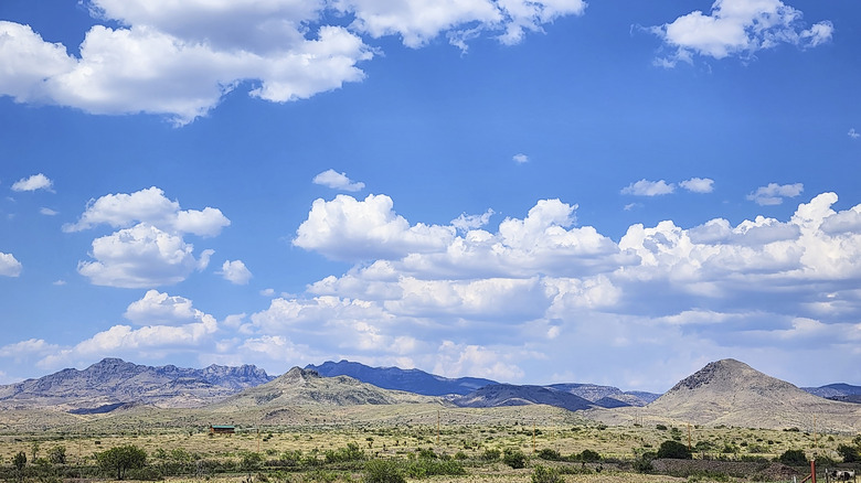
Circling its namesake peaks in a sublime show of jagged summits and dusty plateaus, this 75-mile rodeo is a jaw-dropping ride to say the least. It involves cruising long sections of Highway 118 and Highway 166, past cathedral-like bluffs that shoot above the sun-scorched Chihuahuan Desert to a whopping 8,000 feet above sea level. It takes about 1.5 hours to whiz through the whole thing, but you're likely to want to take plenty longer — there are thick juniper and oak woods to wander, space observatories for cosmic viewing, and canyon hikes to tempt along the way.
The town of Fort Davis is the anchor point of the route, and just getting there to start your scenic romp through the nearby mountains can be a journey in itself. You're looking at about three hours in the car from El Paso, and a whopping six hours from San Antonio, the city that incidentally boasts Texas' trendiest riverside district. The nearest air hub is over at Midland International Airport, a 2.5-hour drive to the northeast.
Read more: The 5 Best Hidden Hot Spring Hikes In California
Driving The Davis Mountains Scenic Loop
Most people begin this wow-inducing drive at the town with the highest elevation in Texas. Fort Davis sits at the intersection of two highland roadways, which combine to create the scenic loop in all its glorious entirety. The Davis Mountains Scenic Loop can be done either way around, cruising west along Highway 118 and then veering off south and east onto Highway 166, or going in the opposite, clockwise direction. Spectacular views abound either way!
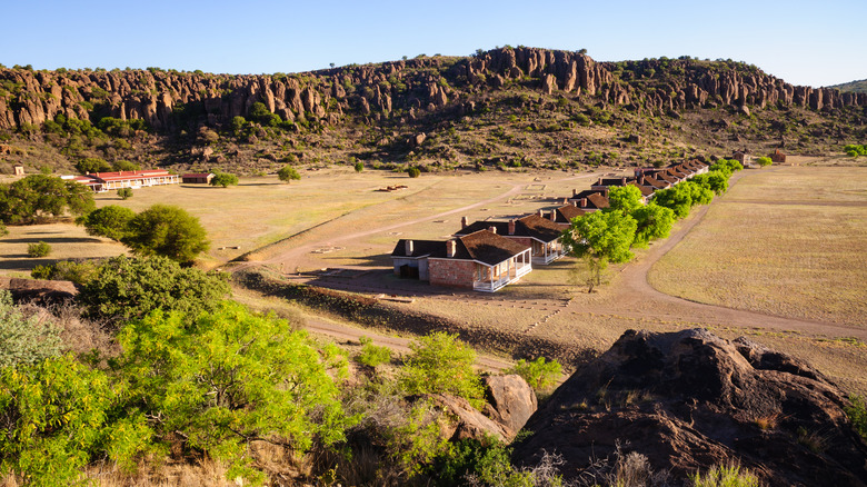
There are some stops you'll want to ensure make it onto the itinerary. The Fort Davis National Historic Site is a good first pitstop as it's near the route's starting location and happens to be a fantastically preserved frontier fort from the 1880s. Astronomy buffs will appreciate the McDonald Observatory that pops up about 20 minutes along Highway 118 from Fort Davis. Head there for solar viewing — programs that inform visitors of the features of the sun — in the daytime, or drop by at night for incredible stargazing.
At another point in the drive, the route bends around the whole massif of Mount Livermore. It's a fantastic sight to behold, involving 8,382 feet of shark-fin-shaped rock rising above the desert. You can even hike it if you're up for a challenge, on a 6-mile out-and-back trail that involves some strenuous scrambles. There are also plenty of scenic pullouts along the route, as well as optional detours to nearby spots, including Texas' most unique town: Marfa.
Ready to discover more hidden gems and expert travel tips? Subscribe to our free newsletter for access to the world's best-kept travel secrets.
Read the original article on Islands.