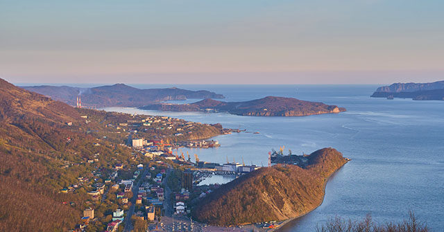
A powerful earthquake measuring 7.4 on the Richter scale struck off the coast of Russia's Kamchatka Peninsula, sending shockwaves through the region. The seismic event unfolded amidst a series of aftershocks,
Did You Know
The Eiffel Tower can be 15 cm taller during the summer due to thermal expansion.
?
AD
prompting immediate tsunami alerts for nearby areas, including Hawaii and the Kuril Islands. Residents in the Kamchatka region were advised to evacuate to higher ground as local officials scrambled to assess the risks and prepare for potential tsunami waves that could threaten coastal communities.
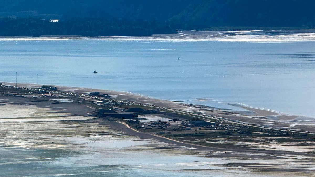
The tremors were felt as far away as Alaska and Japan, raising alarms over the Pacific Ring of Fire, a region known for its tectonic activity. In response to the alerts, officials from various agencies acted quickly to implement safety measures, directing local inhabitants to move inland and ascend to elevations of at least 30-40 meters. Fortunately, assessments determined that the immediate threat of a significant tsunami had passed, leading to the eventual lifting of warnings after confirmation that danger levels had subsided.
This recent seismic activity not only highlights the inherent risks faced by communities situated in geologically volatile areas but also underscores the importance of preparedness in the face of nature's unpredictability. The rapid and coordinated response from local authorities showcases their dedication to public safety, reflecting their commitment to protecting residents amid potential disasters. As the dust settles from this event, it serves as a poignant reminder of the power of nature and the resilience of those who live in its path.
Q&A (Auto-generated by AI)
What causes earthquakes in Kamchatka?
Kamchatka is located along the Pacific Ring of Fire, where tectonic plates converge, leading to frequent seismic activity. The subduction of the Pacific Plate beneath the North American Plate creates significant geological stress, resulting in earthquakes. This region has a history of powerful quakes, such as the recent 7.4 magnitude earthquake, which highlights the ongoing tectonic movements.
How do tsunami warnings get issued?
Tsunami warnings are issued by monitoring agencies such as the Pacific Tsunami Warning Center. They analyze seismic data from earthquakes and oceanographic measurements to assess tsunami risk. If an earthquake exceeds a certain magnitude and occurs near a coast, a warning is quickly disseminated to alert residents of potential tsunami threats, as seen after the recent earthquakes in Kamchatka.
What is the history of tsunamis in Russia?
Russia, particularly the Kamchatka Peninsula, has a history of tsunami events due to its location along tectonic plate boundaries. Notable tsunamis were triggered by significant earthquakes, including those in 2003 and 2009. The region's seismic activity continues to pose risks, leading to tsunami warnings following recent earthquakes, demonstrating the ongoing threat to coastal communities.
How are earthquake magnitudes measured?
Earthquake magnitudes are measured using the Richter scale or the moment magnitude scale (Mw). These scales quantify the energy released during an earthquake based on seismic wave amplitude and the geological characteristics of the affected area. The recent 7.4 magnitude earthquake in Kamchatka was assessed using these methods, allowing scientists to communicate the earthquake's strength effectively.
What safety measures are in place for tsunamis?
Safety measures for tsunamis include early warning systems, public education, and evacuation plans. Coastal communities often conduct drills to prepare for potential tsunamis. After recent earthquakes in Kamchatka, authorities advised residents to move to higher ground, demonstrating the importance of preparedness in mitigating tsunami risks and ensuring public safety.