The Cold War introduced the world to the concept of mutually assured destruction. This was an arms race that saw sides on both sides of the Iron Curtain scrabble to gain an edge. One area where this was fought
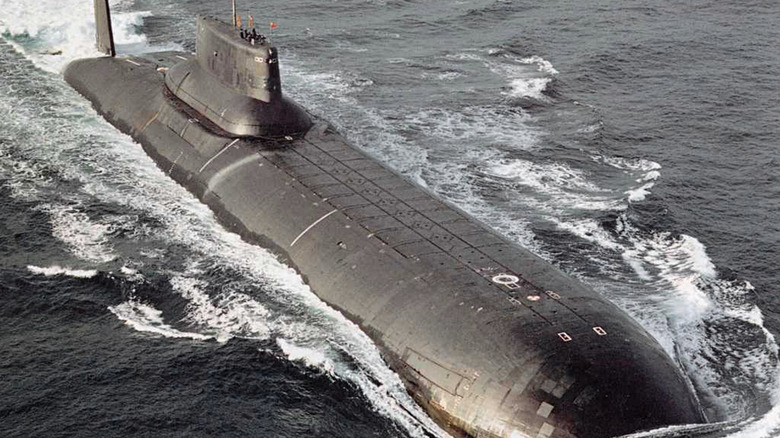
was under the ocean. However, despite making some of the best submarines of the Cold War era, early Soviet submarines were not known for their stealth qualities. Notoriously noisy, they could be detected with the right equipment. This is where a classified US program known as Project Caesar came into play. More formally known as the Sound Surveillance System (SOSUS), it started life in 1954 with the aim of tracking Soviet submarines by listening for the sounds of machinery and the noise created by the cavitation effect of their propellers.
The development of the SOSUS system was made possible by a convergence of two events. These were the discoveries that low-frequency sounds could travel hundreds of miles underwater, and that submarines produced such sounds. Once this was realized, the US Navy moved quickly to build the system. SOSUS used passive hydrophone arrays that were connected by cables to ground stations. At the height of the Cold War, there were over 4,000 personnel based in 20 shore stations and hydrophone arrays situated in strategic locations across both the Pacific and Atlantic Oceans. Despite such a large presence of both hardware and personnel, the Soviets remained unaware of the system's importance until they received intelligence through the Walker spy ring in the 1970s and 1980s.
Read more: 10 Of The Largest Navies In The World, Ranked By Self-Reported Total Naval Assets
How SOSUS Detected Soviet Submarines
The first SOSUS base was commissioned at the Naval Facility at Ramey Air Force Base in Puerto Rico on 18th September 1954. These bases were to become known as "Caesar Stations," and in each station were rows of recorders. These displayed the sounds received by the hydrophone arrays on large scrolls of paper. The recorders each displayed the sound from an individual "beam" -- a beam being a sound received from a particular direction. The analysts who manned stations walked up and down the rows of recorders, interpreting the data that each machine was recording. This was an exercise that became known as "walking the beams." Although there is no longer a requirement to perform the walking function, the process of monitoring the stations is still called walking the beams.
In terms of the Atlantic Ocean, the detection of submarines was centered on an acronym known as the GIUK Gap. This was a series of hydrophone arrays that spread across the naval choke point of Greenland, Iceland, and the UK (hence the GIUK). This was the corridor that Soviet submarines had to pass through to enter the Atlantic on their way to their patrol zones, which often would be close to the US east coast. The system could detect the noises made by Soviet diesel and nuclear submarines as they passed through the choke point, and could triangulate the position of the submarines when it was detected across multiple arrays.
Detecting Whales And Tragedies
While its primary mission was to track the movement and whereabouts of Soviet submarines, SOSUS also found itself at the center of a couple of tragic incidents concerning US submarines. Specifically, it was able to use gathered data to confirm the sinking and position of the USS Thresher in 1963. The Thresher suffered a catastrophic implosion, resulting in the tragic loss of the submarine and its entire 129-man crew. A few years later, on 22nd May 1968, SOSUS was instrumental in detecting the mysterious demise of the USS Scorpion and its 99 crew members in a similar incident. That same year, it also detected the destruction of the Soviet submarine designated as K-129. Famously, the forward section of this submarine was recovered in a clandestine CIA operation.
However, tracking submarines was not the only use that SOSUS has been put to. The National Oceanic and Atmospheric Administration has also been granted access to certain SOSUS data. This has been used to monitor seismic and volcanic activity along the Northeast Pacific region. It has also been used to track whales to help identify migration patterns and measure ocean temperatures to see how they're responding to climate change. The latter is possible thanks to the effect that water temperatures have on the speed of sound waves.
Want the latest in tech and auto trends? Subscribe to our free newsletter for the latest headlines, expert guides, and how-to tips, one email at a time.
Read the original article on SlashGear.